On the hot day of 17 november 2006, my class and 3D had a geography field trip at Labrador Park. It was supposedly to clear our understanding of concepts and to link what was observed in the field to what was learnt in the classroom.
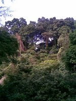
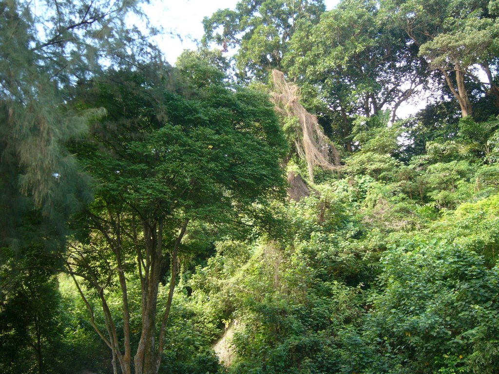
When we arrived, our first stop was at the Aerial Tower. It was built mainly to offer a prime view of the cliff side vegetation coupled with a panoramic view of the sea. On our way down, i was able to observe closely the features of the forest. Lianas were "creeping" on the trees. I was also able to see the continuous canopy, which blocked out quite a bit of sunlight, thats why it was quite dark while i was walking down. Mesh netting were being put to conserve the soil and i was also able to catch glimpses of decomposing leaves. At the lower layer of the forest, i realised that it was made up of moss algae and different kinds of ferns, like the bird's nest fern and the dragon scale fern. When we finally reached concrete ground, i was astounded when i saw the height of these trees and how high 40-50m looked like. There the class were made to sketch out how a tropical rainforest would look like.
Our next stop was at the jetty to get a good view of the wave-cut platform. We were also once again made to sketch out what it looked like. We then went down to the beach to measure the wave period that break at the beach using a stopwatch. The result was about 17 per minute. There we also saw a notch that was formed at the bottom of the cliff due to erosion.
We then moved over to the Promenade where seawalls were being used as theit coastal protection. Seawalls are retaining walls built on and parallel to the coast to protect it from wave erosion. We also counted the wave period there and the result was about 13 per minute, 4 less than when we calcualted in the jetty.
Our final stop was at the Dragon's Teeth Gate. There I was able to see how rocks would look like after going through oxidation, that would cause a change in the colour of the rocks. There was also biological weathering as plants were growing on the top of the cliff as the roots of the plant would grow into joints or cracks in the rocks.
This trip did not actually mean much to me at first, however i found it very useful when i realised how much i have learnt unknowingly. I feel that this is a very good way of learning as it is easier and more interesting as we are able to experience what we have learnt in our textbook first hand. Also because of how interesting it was, i was able to bear with the heat of the blazing sun. I look forward to more fieldtrips like that. It makes learning a whole lot easier.
Tuesday, December 12, 2006
Wednesday, December 6, 2006
Eric
On a blazing sunny afternoon, our geography teacher, Ms Chee, invited us, the Queenstown geographers to a 'hot' date at Labrador Park. At first, i thought it would turned out to be a boring and no value-added trip as geography, in my opinion should be a dull and dead subject. During the trip, my understanding on geography started to change as we went past the Aerial Tower, the Jetty, the Promenade and the Dragon Teeth Gate.
At the first station, the Aerial Tower, we were exposed to the tropical rainforest. As we walked down the stairs from the top of the tower to the bottom, i saw some protecting features used to protect the rainforest. For example, concretes and netting equipments were used to protect the soil from eroding. Points from the notes are confirmed to be true as i have witnessed the downward pointing drip tip and the broad surface of the leave, found in my natural vegetation's notes. At the bottom of the rainforest, there were the buttress roots used to anchor the trees firmly on the ground. We were also made to sketch the structure of the rainforest. Through this activity, it allowed me to have a better understanding of the five distinct structures. Namely the Emergent, the Canopy, the understorey, the shrub and the ground layers.
Next, we moved on to the Jetty. At the Jetty, we were to carry out a simple activity to recap on the chapter on coastal studies. We were made to count the wave period, which is the numbers of breaking waves per minute. The results that we had were between 13-15 which is a spilling wave. We also discovered an erosional feature that is formed when eroded by waves. The feature was a notch. Through the help of the notes, i know that further erosion of the notch will result in a cave, then a cliff found nearly perpendicular to a wave-cut platform. We were also asked to sketch out the coastline of the beach which further more helped me to know more about headland and bay.
As we were on our way to our next stop, the Promenade, we saw a lot of protecting features that were used to protect the coast from eroding away. One of the main features we saw was the seawall. Seawalls were used to protect the coast from strong waves which were commonly experienced near the coast of the Labrador Park. There are also many other protecting features such as breakwaters and groynes. At the Promenade, we were asked to carry out the same activity at the Jetty which was to count the wave period. The results that we found were the same at the Jetty. In other words, both places experienced the same waves.
Lastly, when we were at the Dragon Teeth Gate, weathering was put to use here as we learnt how it can shape different types of rocks. One type of the rocks we saw was weathered by oxidation. We knew because it had turned red which means iron which presenced in the rock chemically reacted with the oxygen found in the air.
My conclusion for this trip is that, despite the fact that the sun was a test to us, we still managed to complete the trip and used three of the geography subjects, Natural Vegtation, Coastal Studies and Weathering. I believed that from that day onwards, i will not despise geography field trip anymore and i will definitely appreciate it.
Tuesday, December 5, 2006
RICO (~.~)
Okay, so on a wild sunny day we've all decided to go on a trip to the Labrador Park to further our knowledge of plants and vegetation through practical work.
First of all destinations was the Aerial Tower, from where we started right from the top slowly descending to the ground level. We were made to do sketches of features seen during the Aerial Tower walk. We observed the characteristics of the trees and leaves as well, such as the the big buttress roots which clinged onto the sides of the wall.
Err.. then after the long walk we headed straight to the jetty. From there we had a live view of how a wave-cut platform looked like, rather from those assignments and notes. We were also asked to count the number of waves within 1 minute. This was to measure wave periods using only a stopwatch and your mouth. The seawalls were also seen firsthanded, rocks made along the shore to counter the abrasion effects from the waves and to prevent further erosion.
And finally, just before the depature of Labrador park, we made way to the Dragon Teeth Gate to witness the effects of Oxidation, the lines of weaknesses and the color change of the rock. It was a wonderful sight and we even managed to take a group picture around the rock.
In conclusion, the trip made 3 hours of study worthy for all of us rather than spending it in a classroom reading lines of black and sheets of white. I enjoyed the trip despite the troublesome fact of walking under the hot sun and I'm looking forward to another trip.
JACKIE ^^
The fieldtrip to the Labrador Nature Reserve was a fun-learning experience.
From the Aerial Tower to the Jetty to the Promenade and lastly the Dragon Teeth Gate.
We were exposed to facts we learnt in class,topics like Natural Vegetation,Weathering and Coastal Studies.
Walking down the stairs of the Aerial Tower,we get to experience the Tropical Rainforest in an equatorial climate.
Features like the five distinct layers-
the emergent,canopy,understorey,shrub,ground layers and trees which are 40-50m tall.
Leaves which are thick and leathery,smooth and waxy with downward pointing drip tips.
Smooth,thin barks and also shallow roots and buttress roots.
Unfortuantely,the forest is a secondary forest.
At the jetty,we get to experience the low tide.
We were taught how to calculate the wave period with a stopwatch and to observe the swash with white foams.
Features like the notch,wave-cut platorm,cliff.
Having a better understanding for the swash,backwash and the difference between constructive and destructive waves.
As we proceed further down to the Promenade,we also learnt about the protecting of the coast. Seawalls were built to reduce the effect of the strong waves which in turn help to prevent further erosion.
Last but not least,at the Dragon Gate teeth,we were told that the type of rock found there was granite and it would be broken down into smaller pieces due to oxidation.
We were made to observe the lines of weakness found on the rock,which would thus hasten the rate of weathering of the rock.
Also,we experienced the sea breeze which kept us comfortable despite the hot weather.
In conclusion,i feel that the trip to the Labrador Nature Reserve is worthwhile beacuse i know i have learnt quite abit.
Looking forward to further fieldtrips planned.
Bethany
Labrador Park was an ideal excursion to open our eyes and broaden our views on what we’ve been studying in black and white for the past few months. It was personally very enjoyable as we got to see with our own eyes the features e.g Rainforest, Sea Walls, Weathered rock. We were also able to study the characteristics of each feature we observed.
The first location at the Aerial Tower, was the Rainforest itself. I noticed the distinct layers of the Rainforest, namely the Emergent, Canopy, Understorey, Shrub and Ground Layer. I also observed the leaves had a down ward pointing drip-tip. Upon touching the leaves, I realized they were smooth and waxy, like what we studied in the notes, which allows rain water to flow off the leaf easily. This gave me first hand experience. I also noticed that environmentalist working at the reserve used curvy plastic (what’re they called?) to hold the soil firm to prevent soil erosion from occurring easily, the sloping forest floor contributed to it.
Moving on, we stood along a bridge above a wave-cut platform and a cliff, and were asked to draw a sketch of it. Not only do we study and know facts about it, but we were able to see it for ourselves. The cliff was covered in slight vegetation and the wave-cut platform had medium sized boulders aligned along the shore. I also noticed the swash, back wash and the white foam the waves brought in. It was pretty peaceful, calming and enjoyable to be there.
After that, we visited the Promenade. There we observed one of the methods we studied, used to protect coastal erosion. The Sea Wall. It was built along side the railing that separated the people and the water. Since the amount of water there is much more, the larger the fetch and then the stronger the wave power. The sea wall was built to repel the oncoming strong waves from eroding the shore too fast, by allowing the direct force of the waves onto the Sea wall itself. I thought it was interesting.
Lastly, we came to the Dragon Teeth Gate. There we were able to observe rock weathering taking place. More specifically, oxidation. The reddish-brown colour on the surface of the rock told us that iron oxide was present.. thus bringing along the colour upon weathering. There was also plants growing above the rock, which referred us to Biological Weathering, where this time plants were involved.
Lastly, we also read a small portion of the History of the Dragon Teeth Gate and its origin and meaning. Although, I really cannot remember any of it. Just that a certain man named William Farquar was one of the pioneers. I really enjoyed my time there as it opened my eyes to the beauty of it all, rather than just reading, studying and memorizing about it from sheets of paper. Thank you Ms Chee for the excursion (:
Group 4: History of Labrador Park
Labrador Park is an oasis of tranquility and natural wonder. The park offers a picturesque view of the sea. It is located along the Labrador Villa Road off Pasir Panjang Road.
Labrador was originally gazette as a nature reserve under the old Nature Reserves Ordinance. More recently, the 10ha coastal secondary vegetation and the rocky shore have been gazette as a Nature Reserve since 1 January 2002. The size of the park is 6.8ha.
Besides its rich biodiversity, the park played a significant role in the history of Singapore during World War II. Remnants of the past like the war relics, tunnels and a fort enable visitors to have an interactive experience of the military of the British rule during the era. These war relics are now surrounded by natural forest.
The rock is believed to have helped Cheng Ho navigate waters around Singapore
A rock that China's most feted explorer, Admiral Cheng Ho (Zheng he), might have used while navigating through Singapore's waters will be re-created to mark the 600th anniversary of his first voyage.
Popularly called Long Ya Men or Dragon's Tooth Gate because of its shape, the landmark, just off what is Labrador Park today, helped steer ships through Keppel Harbour until the British destroyed it in the mid-19th century to widen the channel.
In July, a replica of Long Ya Men at Labrador Park, off Pasir Panjang Road, will be put up by the Singapore Tourism Board (STB), the Maritime and Port Authority of Singapore (MPA) and the National Parks Board.
Signboard telling Cheng Ho's story will also be put up at the park.
The 6m-high reconstructed rock, made of stone similar to the original, will take the place of the Berlayar Beacon, which was put up wafter World War II, and will remain a permanent feature at the park.
The removal of the beacon for the reconstruction of Long Ya Men will not affect safety as there are other aids to navigation in the area, said an MPA spokesman.
The re-creation of the Long Ya Men is a part of the three-month-long celebration here, beginning in July, of Cheng Ho's journeys.
"Singapore's port is very well known but there is nothing to showcase our maritime achievements, both to the locals as well as tourists," said STB's assistant director for culture and heritage, Ms Goh Kershing. "Cheng Ho's anniversary gave us an opportunity to highlight this heritage."
The Maritime Museum on Sentosa, which used to serve this role, was closed in 2002. The admiral's records of his epic travels show that Singpaore has always been one of the greatest ports in the world, said the secretary of the Friends of Admiral Zheng He Society, Mr Chung Chee Kit. The society, started in 2003 by fans of the ancient navigator, has about 40 members. The Ming dynasty eunuch explorer's maiden voyage lasted about two years and took him to Vietnam, Jave, Malacca, Sri Lanka and India. "I'm glad we are celebrating his anniversary in a big way", Mr Chung said.
Cheng Ho, who is reported to have died not long after his last voyage (believed to be to Thailand and Malacca), made seven voyages between 1405 and 1433 venturing as far as the South Pacific, the Indian Ocean, the Persian Gulf and even Africa -- decaded before Spaniard Christopher Columbus went in search of a sea route to Asia.
He travelled with up to 300 junks and 27,000 men at a time. Although there is no record of Cheng Ho setting foot on Singapore's shores, a dotted line in his navigational map, believed to be one of the routes he took, passes through Pedra Branca, an island east of Singapore, and the Long Ya Men. Very few artefacts of his expeditions are left as they were destroyed when China adopted an isolationist policy.
Ms Stella Kon, author of the famed play about a Peranakan matriach, Emily of Emerald Hill, was so stirred by the purge that she wrote a play called "Dragon's Tooth Gate" in 1985 about the anger felt by one of Cheng Ho's associates at the incident. She said of the re-created monument: "It is wonderful that the explorer is finally recognised.”
Monday, December 4, 2006
Eddie
During the field trip, I witness how geography can form our natural environment. Being at the nature reserve also allowed me to review the reserve and it’s history. Finally, going for the field trip also gives me a chance to review my chapters on Natural Vegetation, Coastal Studies and Weathering and allow me to better understand the chapters.
At the first station, Aerial Tower, we were able to see how does a tropical rainforest looks like in real life instead of the diagrams that we see in the textbooks.
The second station, Rocky Beach, we were able to see how waves shape our coast. during the time we reach the beach, it was the low tide period and we were able to see a notch in the cliff which was formed due to erosion done by the waves.
Along the third station, The Promenade, we were able to see how the coasts are protected against wave erosion. Seawalls are built along the coast where there is strong swash to prevent the materials along the coast to be carried away by the strong swash.
Finally at the fourth station, Dragon Teeth Gate, we were able to see how weathering can shape rocks and change their appearance like oxidation which turns the rocks, containing iron, reddish brown. Also we are able to see that chemical weathering is more dominant in tropical regions as there are little presence of physical weathering. All in all, this field trip made me realize that geography is all around us.
kuankoon
After going to Labrador Nature Reserve, I think I know better about coastal studies. Actually, fieldtrip learning is more fun. At Labrador, I see the things that I learn form the notes. With 3D images, it is less boring compared to 2D which is 'liveless'. What i learn in geography actually relate to mother earth. I also know how to calculate wave periods. I saw the swash with white foams. The trip started from the top of Labrador and along the stairs i saw the tree layers. I recap about natural vegetation. On the beach with rocks I see the cliff and wave cut platform. I also saw seawalls. There are many things to explore at Labrador and the view of the surrounding is nice. Hope that there is more fieldtrips next time so everyone can have more fun and play when learning.
Copyright Laws
Dear all,
Please ensure that you credit the sources from which you've extracted photographs/ pictures etc (e.g. website address), excluding those which you've taken using your own cameras.
Groups 2 & 3, appreciate that you've completed your work. Do, however, make the necessary amendments by providing the relevant information. Thanks!
Sunday, December 3, 2006
Group1 - Location1 : Natural Vegetation
GEOGRAPHY
LABRADOR PARK FIELDTRIP 2006
LABRADOR PARK FIELDTRIP 2006
The Labrador Park Fieldtrip is our second trip of the year. The main purpose of having this trip is to step out of the classroom and take a look on the features of rainforest, coast studies, as well as weatherings. The main focus of our group is on the Natural Vegetation. The main intention of having this field trip was to allowed us to see how does a real Tropical Rainforest looks like , rather than viewing it blankly in the textbooks or notes .

Introduction of the Tropical Rainforest
Tropical Rainforest are found mainly around the area of the Equator, where it experience equatorial climate all year round. Tropical rainforest are abundant in parts of Central and South America, Central Africa and parts of Southeast Asia eg. Singapore, Malaysia, Indonesia, Philippines and so on.
Tropical rainforests around the world are quite diverse, but share several defining characteristics including climate, precipitation, canopy structure, complex symbiotic relationships, and different kinds of species. The tropical rainforest is able to grow under optimal growing conditions like abundant precipitation and year round warmth. There is no annual rhythm to the forest; rather each species has evolved its own flowering and fruiting seasons. Sunlight is a major limiting factor. A variety of way to be seen in order to reach light and to adapt to the low intensity of light beneath the canopy.
Structure of the Tropical Rainforest


The Tropical Rainforest is made up of five various distinct layers. They are the Emergent, Canopy, Understorey, Shrub and Ground Layers
The Emergent layer - Widely spaced trees 40 to 50 meters tall and with umbrella-shaped canopies extend above the general canopy of the forest. They are often large with straight trunks, supported by a system of shallow, wide speading buttress roots.
The Emergent layer - Widely spaced trees 40 to 50 meters tall and with umbrella-shaped canopies extend above the general canopy of the forest. They are often large with straight trunks, supported by a system of shallow, wide speading buttress roots.
The Canopy layer- A closed canopy of 30 meters trees. Light is readily available at the top of this layer, but greatly reduced below it. Therefore, the closed canopy grows so close that its crowns appear to interlock, forming a continuous canopy. This actually helps to shuts off most of the sunlight from the forest floor.
The Understorey layer – Small slender trees which grow to a height of between 10 to 30 meters. There is little air movement in this zone and consequently humidity is constantly high.
The Shrub layer - Less than 3 percent of the light intercepted at the top of the forest canopy passes to this layer. Arrested growth is characteristic of young trees capable of a rapid surge of growth when a gap in canopy above them opens.
The Ground layer - Sparse plant growth. Less than 1 percent of the light that strikes the top of the forest penetrates to the forest floor. In such darkness few green plants grow. Only plants like ferns mosses, fungi, which does not need many sunlight will grow in that layer. Moisture is also reduced by the canopy above: one third of the precipitation is intercepted before it reaches the ground.
Other than seeing the distinct layer of the Tropical Rainforest, we also are able to see the various Typical of Rainforest plants, found in both Canopy and Understorey layer. They are the Epiphytes, Lianas and Climbers.


Epiphytes - The so-called air plants grow on branches high in the trees, using the limbs merely for support and extracting moisture from the air and trapping the constant leaf-fall and wind-blown dust. Bromeliads (pineapple family) are especially abundant in the neotropics; the orchid family is widely distributed in all three formations of the tropical rainforest. As demonstration of the relative aridity of exposed branches in the high canopy, epiphytic cacti also occur in the Americas.
Lianas - Woody vines grow rapidly up the tree trunks when there is a temporary gap in the canopy and flower and fruit in the tree tops of the understorey and canopy layers.
Climbers - Green-stemmed plants such as philodendron that remain in the understory. Many climbers, including the ancestors of the domesticated yams (Africa) and sweet potatoes (South America), store nutrients in roots and tubers.
Characteristics of the Tropical Rainforest

The Tropical Rainforest has different characteristics to adapt to the changes of the Equatorial Climate. The following below shows the different kinds of the characteristics that enable the Forest to continue to grow.
Buttresses roots are roots which have broad, woody flanges at the base of the trunk. Believed to help support the tree other than that buttresses channel stem flow and it’s dissolved nutrients to the roots.
Broad leaves are common among trees of the Emergent layer. Young individuals of trees destined for the canopy and understorey layers may also have large trees. When the reach the canopy new leaves will be smaller. The large leaf surface helps intercept light in the sun-dappled lower strata of the forest.
Downward Dripping tips leaves are facilitate drainage of precipitation off the leaf to promote transpiration. They occur in the lower layers and among the saplings of species of the emergent layer.
Comparing Tropical Rainforest to the other Forests
In drier, temperate deciduous forests a thick bark helps to limit moisture evaporation from the tree's trunk. Since this is not a concern in the high humidity of tropical rainforests, most trees have a thin, smooth bark. The smoothness of the bark may also make it difficult for other plants to grow.
Why Is There A Need To Conserve The Tropical Rainforest?
Tropical Rainforest is known as one of the world’s richest ecosystems, therefore it also provide many resources like woods to burn fires, papers, furniture- making, ropes and are also used in construction industries. Other than woods, the Tropical Rainforest include resins, which provide natural dyes. Plants which contains spices, also local fruits like berry and mangoes. There are also medically valuable plant species.
Nowadays, rainforest have been seriously depleted by the increasing land being used for commercial, recreational and industrial uses .Tropical rainforest trees and plants also remove carbon dioxide from the atmosphere and store it in their roots, stems, leaves, and branches. Imagine , if the rainforest were to become extinct due to human actions , there will be lesser plants to recycle the air , thus , we will have to breathe in most of the carbon dioxide ! Scary isn't it ?
Therefore , conserving Tropical rainforest is certainly important and neccessary ! Whenever you want to waste any natural resources , stop and think of the dreadful consequences
Soil Conversation


There are many different kinds of soil conversation to prevent soil erosion, such as putting net, placing the tiles to prevent soil erosion . At the Labrador Park, we are able to observe several kinds of soil conversation, which were shown above. The kinds of conservation were man-made . However , these are not the best resolution as they may actually cost a bomb if the government wanted to build a lot of it. Therefore , these kind of man-made conservation are only affordable to the developed countries like Singapore. For developing countries like India, they will have to plant a lot more trees, as the roots help to stabilize and hold the soil together on slopes to prevent erosion. Futhermore , it's much more cheaper planting more trees ,instead of constructing the man-made soil conservation.
Why Is There A Need Of Having Soil Conservation?

There is a need to have soil conversation in the Tropical Rainforest is to prevent soil erosion. Especially in the Countries which experience hot and wet climate all year round. Countries like India, which may experience flooding due to prevailing monsoon. Therefore by having soil conversation, it helps to prevent loss of soil fertility (nutrient cycle and soil leaching), preventing increasing in water pollution and flooding, increase in greenhouse effect and loss of plant and animal species.
Nature slowly wears away land, but human activities such as construction increase the rate of erosion 200, even 2,000 times that amount. When we remove vegetation or other objects that hold soil in place, we expose it to the action of wind and water and increase its chances of eroding.
With all the contributiing factors, the enitire Tropical Rainforest’s habitat will gradually be destroyed , if the worst come to worst, it may lead to greenhouse effects and changes in Global Climate , which may result in global warming . Infertile of soil can also lead to extinction of trees .
Sources:Secondary 3 Geography Textbook
Pictures taken by Group Members at Labrador Park
www.yahoo.com
www.stagsleapwinery.com/art/2002_fall/Geology.pdf
www.yahoo.com
www.stagsleapwinery.com/art/2002_fall/Geology.pdf
Done by :
Chng Pei Sze
Chua Mei Qi
Goh Pan Hui
Ho Yenn Ting
Ann Lee
Chan Li Zhong
Chia Kuan Koon
Eric Ng
Eddie Koh
of sec3B'06
Group2 -Location2 :Coastal Studies
Introduction
On November 17, 2006, we went to Labrador Nature Reserve. The objective was to enhance our learning about Coastal Studies. At there, we see the features that were coastal-related. Not only that, we also recapped what we have learnt for the topic on Natural Vegetation and Weathering.
Coast Profile

Coast is the area between the land and sea.
Shore is the area between the lowest and the highest water level.
Backshore lies between the high water level and the highest water level.
Foreshore lies between the lowest water level and the high water level.
Offshore is never exposed.
Waves
It is the surface of the water which rises and falls when wind blows across the sea.
At Labrador Nature Reserve, we measured the wave period of the wave that breaks at the Promenade and the beach.
Parts of a Wave
Crest is the highest part of wave.
Trough is the lowest part of wave.
Wave height is the vertical distance between crest and trough.
Wave length is the distance between two consecutive crest / trough.
Swash VS. Backwash
White foam that rushes up the shore is the swash, whereas the water that flows back towards the sea is the backwash.
Constructive Waves VS. Destructive Waves
Constructive Waves

- Swash is stronger then Backwash.
- Builds up coasts by deposition.
Destructive Waves

- Backwash is stronger then Swash.
- Erode coast.
Erosional Features

(a) Headland and Bays
Headland is the part of the land that projects out to the sea.(steep rock surface)
Bay is the wide inward curve of land along coast and which compasses part of sea.
Both headland and bay are formed by continual erosion of different resistance rocks. The more resistant rocks erode to form headland, while the less resistant rocks becomes the bay overtime.
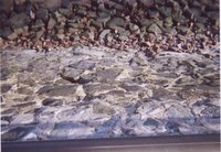
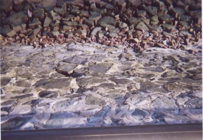
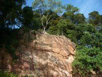
(b)Cliffs and Wave-cut platform
Cliff is a steep coastal rock surface.
Wave-cut platform is a gently sloping coastal land surface.

Below is a picture of a cliff at Labrador Nature Reserve.
.jpg)
At the bottom left, part of the cliff has been eroded by the waves.
Now, take a closer look…
.jpg)
When waves attack steep slope at the coast, erosion causes a notch to be produced. It enlarges to become a cave and further erosion of cave result in the overhanging part collapsing, thus the cliff is formed. Continuous erosion of the cliff would result in the cliff retreating inland and a wave-cut platform is formed at the foot of the cliff.
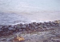
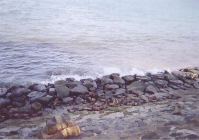
Depositional Features
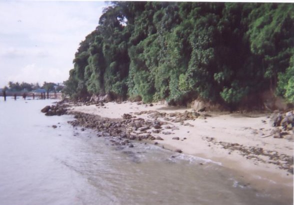
(a) Beaches
It is an accumulation of eroded materials on the shore when the wave energy is low.
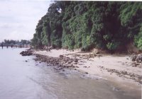
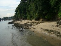
Rocky beach at Labrador Nature Reserve >>>
.jpg)
.jpg)
It is well developed in sheltered coasts, which is a bay between two headlands. Wave refraction causes energy to be dissipated in the bay, resulting in a beach.
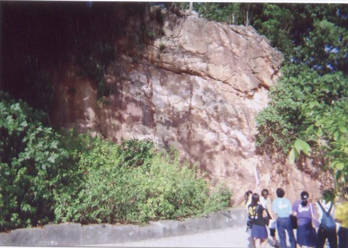
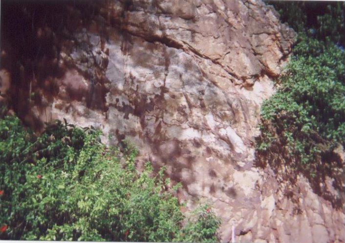
Others
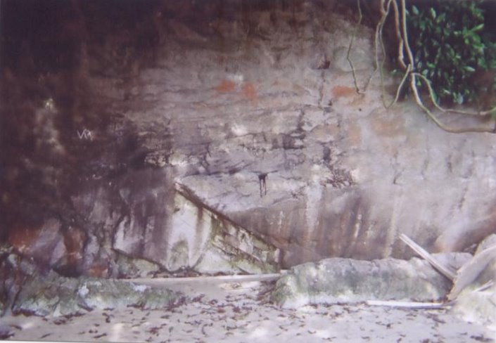
At Labrador Nature Reserve, we have also seen some other aspects of geography like weathering at the dragon teeth gate. We have seen the effects of oxidation on the rocks and the lines of weaknesses between them. Biological weathering also applies there too.
Example of weathering>>>
.jpg)
Also, Labrador Nature Reserve is a tourist attraction and a recreational place. People can be seen at there fishing, jogging, or strolling.
Conclusion
Overall, we have benefited from this assignment. Apart from textbook knowledge, we have observed the coastal shape and learnt how to calculate the wave period. This has helped us to broaden our knowledge on coastal studies. Through experiential learning, we have sure to have shown more interest on geography.
Lastly, we also would want to Thank our geography teacher, Miss Chee, for bringing us to Labrador Nature Reserve for the fieldtrip.
Credits
Snaps are self-taken and diagrams taken from Secondary 3 Interactive Geography Textbook.
Project is done by Group 2.
Group members: Bao Ting, Ivy, Mildred, Nicholas, Xiu Hui, Janet, Yi Rong, Jackie & Rico of 3B’06
PS: All information presented above is mostly according to what is seen during the fieldtrip to Labrador Nature Reserve.
Johans
This trip to the Labrador Nature Reserve was really an eye opener to me,it was not the first time i had visited the reserve but the trip on 17th November really helped me to understand, firstly more about the reserve itself and its history.Secondly,i was exposed to topics that i have learnt in the classroom such as Natural Vegetation, Coastal Studies and Weathering.Lastly,it was also an oppotunity for me to revise on the past chapters that i have learnt so far.
From the reserve,i got to see the different distinct layers of a topical rainforest which i have never taken note of during my past visits.The forest floor was really dense and soil conservation is practised in the area.Roots of trees,properties of leaves and such can be observed from the reserve.
At the jetty,we got to see the wave cut platform as it was low tide at that time and also the coastline.We also had the oppotunity to calculate the wave period by using a stopwatch and observed that waves spill and form white foams.On the beach,we spotted the notch which was expose only during low tide due to erosion of the coast by waves.
At the Promenade,we were able to see how the coast was protected by waves.Sea-walls were spotted at the reserve and serve as a protection against waves.We were also told about swash and backwash.
The last location was the Dragon Teeth Gate,we identified the type of rock that we found there was granite.We were also told that the rock would eventually break down due to oxidation.Lines of weakness in the rock was also spotted that weaken the rock.
Finally,i have learnt to be more aware of our surroundings as geography is all around us,even places like Labrador Park which we usually go there for recreational activities.Therefore to sum up,i would like to say this trip was great learning exprience for me and a beneficial one too.
Nicholas
I used to think that Labrador park is just like any other park you can find anywhere in Singapore. Initially, Labrador park whenever i heard of its name, the impression that will come to me that it is just a war memorial.However, this time i went my impression of it changed, I came to know that it was also a nature reserve.I have gained a clearer picture of what the topics we have learned.
The first area was the aerial tower.The forested area below the aerial tower was similar to the tropical rain forest we learn earlier in the year when we touched on natural vegetation.It is very fascinating to know that there is such a feature in such a urban city like Singapore.I appreciate the efforts of the way environmentalists do to try to prevent the rate of soil erosion.
After climbing down the aerial tower we proceeded to the jetty.It is actually not a beach but a wave-cut platform, although they are look similar.the difference between the both is that wave-cut platform cannot be seen during the high tide while the beach can.There was a cliff over at that area.From the cliff we could see a notch forming at the base of the cliff.The waves that were coming in were all spilling in onto the beach surface.The activity we done there was that we calculated the wave period.That was rather interesting and unique experience as we had never tried before actually counting wave periods.
We then went on to the Promenade.We saw one of the method of coastal protection which was the seawalls.I believe that the walls were built there as the waves heading toward the shore were much more stronger compared to the area where the jetty was.The seawalls will slow down the rate of erosion as when there are stronger waves there will be a larger backwash will lead to a faster rate of erosion.
Finally our last stop was the Dragon Teeth Gate.At the area here we witnessed weathering taking place.The rock there, due to weathering overtime, had turned reddish-brown in colour.So it was obvious that the chemical weathering of oxidation was taking place on the rock.I also could infer from the colour that the rock contained certain traces of iron as oxidation could only occur when there is iron present in the rock.
This trip was one of the few geography field trips that our pure geography class had in the year.It was acting like a reminder to what topics we have learned in the year.I feel that it was more into helping us to recap with the topics that we might not have such a clear understanding upon.And from this experience we have learned not only about the classes we have but also getting to know the environment of little tiny dot country of ours' a little better.
Mildred
Before going to the park, we had learnt about the tropical rainforest in class already, and have seen pictures of it. But it was when we went there that we actually get to see the forest and experience the feeling of being in a rainforest. Though it was hot, but it was a truly enriching trip.
As we walk down the Aerial Tower, we saw many things about the rainforest. We saw the forest floor, which was quite similar from what we learnt. We also saw the leaves, barks. There,we also saw the soil protection.It help to protect the soil from erosion. We also saw the distinct layers of the forest.
We saw a cliff and a wave-cut platform on the bench. There were large rocks too. We saw the oncoming spilling waves that were gentle. All this was what we learnt in class. Also, we learnt to calculate the wave period.
As we walk down the promenade, we saw the coastal protection -seawalls. The waves was stronger there. It was enjoyable walking there as it was very windy. We saw the mark that marks the deep waters too. There were large boulders there too.
At the Dragon Teeth Gate, we saw rocks that was weathered. One of it was going through oxidation.
When we left the place, i had learnt a great deal about coastal studies and weathering.
Janet :)
This is my first fieldtrip to the Labrador Nature Reserve . At first , I had no interest in going to the park . Instead , I feel that it is a wasting time trip. However, after being to the nature reserve, I feel that I had learnt a lot from this trip and gain another trip of experience.
Firstly, we journey down the stairs from the Aerial Tower to the Jetty. In between the journey, we observe a lot of things. The soil conservation they use to secure the soil to prevent soil erosion when rainy days come. From the journey, the nature vegetation of the equatorial climate was clearly pictured into my mind. The 5 distinct layers, the types of leaves, dense undergrowth, lianas and epiphytes, buttress roots and other insects and animals like squirrels. This forest is however, a secondary forest and not a primary forest.
Secondly, we went to the jetty. It is during its low tide and thus we can get a closer distance to the waters. We measured the wave period of the waves that break at the beach by using a stopwatch. We observed that the waves spill and form white foams. The waves are spilling breakers and they are constructive. We also observed the wave-cut platform at the foot of a cliff.
Thirdly, we went to the Promenade. I observed that there is a coastal protection method used to prtect the coast, it is seawalls. Again, at the Promenade, we measured the wave period and there is a difference in the two wave period.The one in the Promenade is lesser than the one in the jetty.
Lastly, we went to the Dragon Teeth Gate. There is signs of biological and chemical weathering taling place there.The evidence from the rocks that there is oxidation taking place as there is reddish-brown iron oxide present on the rock surface.
At the end of the trip we took a photo to prove that pure geo students of class 3b3d 06' had been to the labrador park.
After the trip, I had actually seen the real swash and backwash, lianas, seawalls and others. This is a lesson thst you are unable to learn or see from any of the textbooks and assignments. I hope that there is other fieldtrips avaliable to help us learn more about geography!Lastly , I would like to thank Ms. Chee for this valuable lesson that is taught.
Saturday, December 2, 2006
Lizhong
After the field trip I have learnt more about geography. At the first station, Aerial Tower, I learnt about the distinct layers of a tropical rainforest, the type of vegetations growing in the different layers and the methods used to protect the forest floor. At the second station, Rocky Beach, I am able to witness erosion done by waves to the coast and how these erosion forms the coast. For example, the notch we saw at the coast which was formed due to the erosion of the coast during high tide by the waves. At the third station, The Promenade, we are able to see how the coast is protected from erosion where seawalls are built to prevent strong swash from eroding the coast. Finally at the fourth station, Dragon Teeth Gate, we are able to see how weathering will shape the rocks. For example, we are able to see how rocks containing iron are affected by oxidation and therefore turning the rock to be reddish brown. From this fieldtrip I have learnt how geography is taking place in our actual life and is able to witness it.
Siew Wei
The Labrador Nature Reserve fieldtrip had definitely been an interesting outdoor venture to relate what I have learned in the topic of Coastal Studies, Weathering and Natural Vegetation to the field.


The staircase built on the edge of the secondary forest offer a prime view of the cliff side vegetation coupled with a panoramic view of the cliff. As I journey down the staircase from the Aerial tower where the natural vegetation thrives, to the jetty, I observe the features of the secondary forest and study its characteristics. Many of the tress at there was consider rare. Soil conservation was also done to prevent soil erosion such as mesh netting. A leisurely stroll along the nature trails, different animals and raptors were sighted occasionally such as the squirrels scurrying up trees and the monitor lizards that sun along the foot path.
The Forest The forest floor
2.jpg)
The Forest The forest floor
Fronting the 30m high cliff sides is the 300metres Labrador beach, extremely rich in marine flora and fauna at the beach. The animals exploit the environment created by an exposed rocky shore. I also observed the patterns of approaching waves as well as the general direction from which they come and lastly how the marine processes that shape the coast at Labrador Park. There was also a wave-cut platform at the foot of the cliff, a result of the continuous erosion at the base of cliff causing the cliff to retreat inland.

The Coastline A wave-cut platform
Walking along the Promenade to the soothing sound of the waves, I identified the coastal protection method used along the Promenade which was the seawall that helped to reflect waves away from coast. I have also seen the motion of the swash and the backwash.
Seawall Swash
The Dragon Teeth Gate shows evidence of different types of weathering that took place, such as physical, chemical and biological weathering. I have also learnt the historical significance of the Dragon Teeth Gate that was used to navigate waters around Singapore in the past.
Dragon Teeth Gate Weathering of Dragon Teeth Gate
I think the activity at the Aerial Tower was the most beneficial as it had inculcate a sense of appreciation and understanding the value of Labrador Nature Reserve as one of Singapore’s nature parks and the importance of preserving the natural environment in our landscape.
What I had observed on the fieldtrip help to make what I have learned in the classroom more relevant and interesting as I was exposed to different modes of assessment to measure my learning. As well as an aid in sustaining my interest in Geography through experiential learning.
What I had observed on the fieldtrip help to make what I have learned in the classroom more relevant and interesting as I was exposed to different modes of assessment to measure my learning. As well as an aid in sustaining my interest in Geography through experiential learning.
Thursday, November 30, 2006
Audrey
Before the trip to Labrador Park , I thought that it is just like any other parks and there is nothing special about it . However after the trip , my opinion for it has changed . The trip had allowed us to see how does an actual Tropical Rainforest look like . Initially , I was not quite certain if the properties of the Tropical Rainforest that was taught ages ago , apply to any of the Tropical Rainforest . However , now I can assure that it definitely does ! The hot and wet climate enables plant growth throughout the year . Therefore , Labrador Nature Reserve has a rich variety of flora and fauna that will delight nature lovers. During the trip , I had seen several climbing plants , such as lianas . On the dark and damp forest floor , there was much leaf litter . From what I had learnt previously , leaf litter is essential in the Nutrient Cycle , which is a process that allow nutrients to return to the soil . When we were at the foot of the forest , we can clearly see the five distinct layers of the forest . This evidently proved that what we had learnt was absolutely correct !
I found out that Labrador Nature Reserve contains the only rocky sea-cliff on the main island of Singapore that is accessible to the public for recreation, education and scientific research ! When I knew that we had to get down to the beach to view the wave-cut platform and calculate the Wave Period , I was reluctant to do so as it was filled with algae and other disgusting substances . However , when I was on the beach itself , I realized that it wasn’t that bad . The only difference between the beach there and the beach in East Coast Park , is that you cannot swim there ! Unless , you intend to drown yourselves . At the wave-cut platform , we saw a notch . We were told that we would not be able to see the notch if it is high tide . Therefore , we are considered fortunate to view the notch . It was totally different experience as the notch that we used to see in textbooks and notes were just pictures . Overtime , due to erosion , the cliff will eventually collapse . It was amazing that the simple waves can cause a huge cliff to collapse . Therefore never underestimate the waves !
At the Dragon Teeth Gate , the huge cliff was expose to chemical weathering , oxidation , as it was reddish brown .
The lines of weaknesses of the rock and the humid climate increased the rate of weathering . Overtime , the cliff will eventually collapse . Therefore beware when you are walking under it !
During the trip , we saw the efforts of soil conservations and coastal protection . Example like the net , which helps to prevent the soil from eroding . The seawalls , which help to prevent coastal erosion .
In my point of view , I felt that Natural Vegetation is essential to our life . Without it , we will hardly survive as it provide us with endless supply of oxygen and played important role in various aspects . Simple things such as wasting paper , hence , resulting in further deforestation . By cutting down more trees will affect the nutrient cycle , thus , the soil will be infertile and prone to erosion . Due to the development of present world now , the demands of high living standards also increase drastically . Which means that more forest has to be cleared for infrastructure . Factories are also the culprit for deforestation and polluting of water . Land has to be cleared for it and the chemical substances released into the water will harm marine life . Therefore , I strongly believed that it’s everyone duty to conserve the park .
Although we had to walk under the scorching sun , I believed that everyone had benefited greatly . It had help to broaden my knowledge . There are many things that you can at there , such as fishing . If you are fortunate enough the catch is yours . Isn’t it interesting ? However , most importantly it’s FREE ! Been to Labrador park has given me a truly unique experience and I hope that there will be such trips in the future .
Pei Sze
Location1. The Aerial Tower
 Able to see the distinct layers of the tropical rainforest.
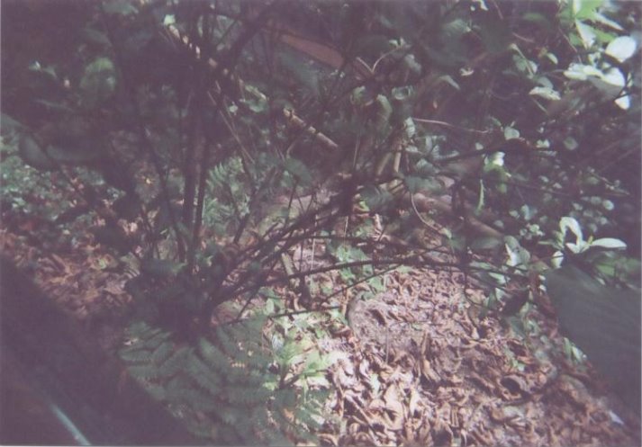
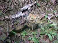 The dense forest's ground floor. This picture shows how the soil conservation is being carried out.
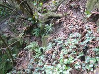 The dense forest's ground floor. The picture also show that the roots of the tree is shallow and buttress.
 The wave cut plateform that we saw( during low-tide), the shape of the coast.
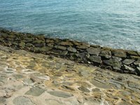 This is the sea-walls that had been built to protect wave erosion.
 From the colour of the rocks, i could say that both chemical and biological weathering took place. But in this case, chemical weathering was much more dominant than biological weathering. As the reddish-brown iron oxide was shown on the surface of the rock, therefore it shown that oxidation took place.
 Able to see the distinct layers of the tropical rainforest.
 The dense forest's ground floor. This picture shows how the soil conservation is being carried out.
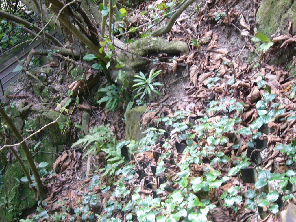 The dense forest's ground floor. The picture also show that the roots of the tree is shallow and buttress.
Location2. Jetty and Rocky Beach
 The wave cut plateform that we saw( during low-tide), the shape of the coast.
Location 3. Promenade
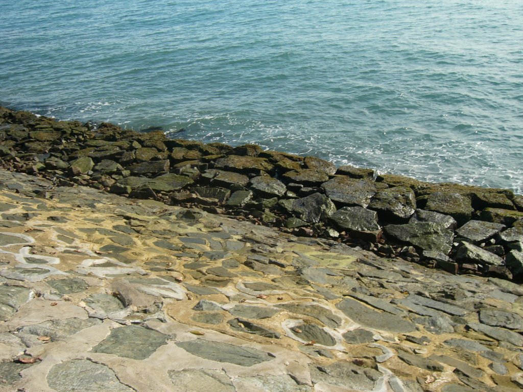 This is the sea-walls that had been built to protect wave erosion.
Location 4. At the Dragon Teeth Gate
 From the colour of the rocks, i could say that both chemical and biological weathering took place. But in this case, chemical weathering was much more dominant than biological weathering. As the reddish-brown iron oxide was shown on the surface of the rock, therefore it shown that oxidation took place.
Ivy
This fieldtrip to the Labrador Park has been a fruitful experience for me. Unlike usual theory lessons in classroom, this lesson has been an interesting one. This fieldtrip has helped me to link and relate what we have learned in class with our natural environment.
The first location was the Aerial Tower where we saw the natural vegetation. Recalling what I have learnt a few months ago, this staircase walk from the Aerial Tower to the Jetty allowed me to look at the structure of the forest, as well as the characteristics of the leaves. I also saw the different methods of soil conservation.
The second location was the Jetty/ Rocky beach where we learnt about coastal studies. We observed the shape of the coastline and also calculated the wave period. We made our way down and saw the wave-cut platform and the notch. We were told that as waves continue to erode the coast, the cave would eventually collapse.
The third location was the Promenade where we observed coastal management. Seawalls were built to protect the coast. We were also told about the backwash and swash.
The final location was the Dragon Teeth Gate where weathering processes takes place. We were told how the rock would break down eventually by oxidation. This is due to the presence of lines of weaknesses that weaken the rock. We also got to know the historical significance of the Dragon Teeth Gate.
Nowadays, as more and more land is being used for commercial, recreational and industrial uses, it is important that we conserve a nature reserve park like Labrador Park. Everyone has a part to play. If we do not play a part in conserving the Mother Nature, what will happen in 10 years time?
Overall, I have gained much knowledge from this fieldtrip, which enabled me to understand the topics better.
Kiti
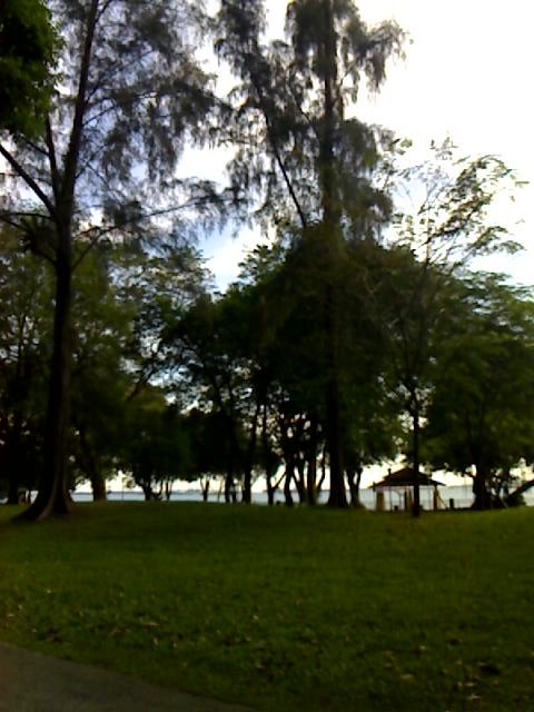 My Reflection
The first location we went to was the Aerial Tower. As we journey down the staircase from the Aerial Tower to the Jetty, I recalled what have been taught in the topic of Natural Vegetation a few months ago. I find it easier to understand what we have learned by looking at the real things rather than just simply reading from the notes or looking at the 2D pictures in it. The leaves in the forest were indeed thick and leathery and smooth and waxy with downward pointing drip tips. Buttress roots were also found. The trees grow very closely to one another, forming a continuous canopy so we were actually sheltered from the sun. The condition inside the forest was hot and humid. The forest floor was dark with lots of leaf litter lying around and little undergrowth was found there. A lot of ants and insects were found in the forest and I saw algae on our way down which I find it surprising. Lianas and a few species of climbing plants were also found in the forest. Methods of soil conservation were also practiced there.
The second location we went to was the Jetty/Rocky Beach. It was lucky for us that we went there during low tide. We saw the wave-cut platform, which is only exposed during the low tide. It was a gently sloping coastal land surface that extends towards the sea from the foot of the cliff. The Rocky Beach was indeed rocky and filled with rocks, with bigger rocks nearer to the foot of the cliff and smaller rocks further away. The beach materials were indeed sorted on the beach. There was a construction of jetty going on. A notch was found at the foot of the cliff. I did not know that it was a notch until Miss Chee pointed it out. Initially I thought that the notch was just an ordinary hole. Further erosion of the notch would make it further enlarged and form a cave. Maybe 50 years later, we would get to see a cave in Labrador Park!
The third location we went to was the Promenade. The coastal protection method used along the Promenade was the building of seawalls. Actually, I have seen seawalls around in Singapore at East Coast and Sentosa in the past few years, but it is just that I did not know how a seawall looks like till this trip to Labrador Park. Building of seawall helps to reduce the effect of the waves and helps to reflect the waves away from the coast. However, building of seawalls have its own disadvantages, powerful backwashes of the reflected waves increase the rate of erosion of the beach materials and also causing the base of the seawalls to weaken resulting in the continuous rebuilding of the seawalls again and again. There are groups of anglers fishing along the Promenade too.
The last location we went to was the Dragon Teeth Gate. The type of rock that is found there is the granite rock. Biological weathering and chemical weathering mainly attacked the type of rock found there. There is evidence of oxidation taking place due the reddish-brown iron oxide that is present on the surface of the rock. The roots of the plants attacked the lines of weaknesses of rocks found there. Remnants of the past like the war relics, tunnels and a fort are also be found there.
Lastly, Labrador Park is one of the few Singapore's nature parks around in Singapore so it is very important to preserve the natural environment in our urban landscape. It is our responsibility to protect and conserve it. Also, Labrador Park is not just a normal park in Singapore. Visitors especially the history and geography students get to observe what they have learned more clearly.
Wednesday, November 29, 2006
Pei Sze

At the Labrador Park, I was being able to have a first hand encounter with the natural vegetation, weathering and the coastal studies, which we had learned them during chapter 5, 9 and 11. The trip had enabled me to know that geography is a subject that can be apply to our surrounding. With this trip I also can experience the things and conceive what we had learned during lesson, from both the notes and textbook.
At the Aerial Tower, where we actually recalled on the tropic on tropical rainforest, which we had studied a few months back. While walking down the steps, we saw a lot different characteristics of the trees, like the leaves, it is smooth and waxy, thick and leathery. The roots are buttress and also shallow that we can actually see the roots sticking out of the ground. Not only just that, when we will walking in the forest, we felt that it was so stuffy. This was because that the forest was so dense that the sun actually cannot enter through the ground floor easily. All this was being learned from the textbook and with this trip we will able to get to encounter the primary experience with just not seeing them in the pictures. Other than that, we also see how the human activities were being applied in order to help to prevent soil erosion from being occurred, other than just planting a lot of plants. Along the way, all of us were like eye-openers, everything to us seems so new and all of us were busy taking down notes and photos. Also reminding each other what to write down and what pictures that we should take.
Due to that we had been there during the time of low tide, all of us were able to see the way cut platform and the whole sharp of the coast. When I saw the notch in the textbook, I thought that it is actually quite small. But the notchthat we had seen there was actually quite big, compare to the notch that I had imagined from the textbook. At the place, we also do a little experiment by calculating the wave length per minute and was ask to draw out the shape of the coastal. Along the way, we saw litters along the coastal, from this I can conclude that human activities can either conserve or destroy the beauty of nature. Along the path of the coastal, we could also see the sea walls and knowing how this man-made structure actually helps to protect the wave erosion through the textbook. I also experience the sea breeze and forgetting the backwash and swash too.
Weathering of the rocks were also been seen when we process to the next location, the cliff that we seen was reddish brown in colour. From that I had applied to what I had learned during lesson that the chemical weathering actually took place, oxidation. Lines of weakness were also been shown and other than chemical weathering took place, biological weathering also took place.
Nowadays due to the development of Singapore, many of the lands had been actually used to build houses and factories, with this, it becomes very important to preserve a original green landscape which Singapore have, instead of being turn into a concrete city. Therefore, it’s our job to preserve what we have now.
All this information that we had learned during lesson actually apply fully to this trip, therefore I could say that this trip was a beneficial one for me.
Howe Yong
Hi. I feel that the trip to Labrador park was a rather meaningful one compared to the last time we were there. As it is a nature reserve, so there will naturally be a lot of conservation going on. However, by conserving Labrador park, we not only conserve our natural vegetation there, we preserve our coastal features there as well and learn the ways in which to protect it. All of this made me realise how fragile nature actually was, and it was of importance to start conserving it. However, we cannot leave such works only to the conservationist out there in the field. We ourselves must also play a part in conserving our natural elements. Ok, now on to the things that we saw during this field trip. Firstly, when we came down from the bus, i saw the floor. Ok, that was crap. Our first destination was in fact, the aerial tower, which gave us a spectacular view of the sea and the natural vegetation, such as the structure of the forest. After that, we made our way down where we came across some methods of soil conservation. After that, we went to the beach where we calculated wave period and we learned about the wave-cut platform and how it was formed. After that we headed along the pathway and along the way, we learned about seawalls and how it prevents the shore from being eroded. Following that, we came across a gigantic cliff that has been battered by the various weathering processes. However, we found out that the main weathering process happening there was in fact oxidation, as the rock was reddish-brown in colour, thus indicating the presence of iron in the rock. Also, there was a gun station just beside the cliff and that was where i met Johnny. Our final destination was at a piece of rock called(direct translation from Chinese)dragon teeth gate. This rock had also been weathered by oxidation as well as the roots of plants. I felt that i learned many things from this trip and i would gladly go back there again. Also, I learned something about my friend too. For example, wang zhi gets nose his bleeding very easily. Thats about all. Thank you.
Some Things to Think About
Dear Geographers,
You may want to address some of the following questions/ issues in your individual reflections:
1) What is the value of conserving Labrador Park as a Nature Reserve?
2) Whose job is it to conserve the environment?
3) Assess/ evaluate the type of conservation work that has taken place at Labrador Nature Reserve.
4) Have you learned anything new about your friends/ classmates on this trip?
Deadline for individual and group assignments remains as stated: 4 Dec 2006, 2359hrs. Kindly remind your friends to pen their thoughts if they have not yet done so. To those who have already submitted a post, your efforts are appreciated and do feel free to post more.
That's all for now...
Siang Yee
After going to Labrador Nature Reserve, I have learnt more about Natural Vegetation, Coastal Studies and Weathering which I learnt in classroom. At the Aerial Tower, I have seen the method of soil conservation and the features of the tropical rainforest.
At the Rocky Beach, I have seen how notch and wave-cut platform look like in the real life. At the Promenade, I learnt that seawalls and rocks protect coast from wave erosion. At the Dragon Teeth Gate, I have seen the effects of oxidation on rocks containing iron minerals. From the fieldtrip, I learnt more about Geography through experiential learning.
At the Rocky Beach, I have seen how notch and wave-cut platform look like in the real life. At the Promenade, I learnt that seawalls and rocks protect coast from wave erosion. At the Dragon Teeth Gate, I have seen the effects of oxidation on rocks containing iron minerals. From the fieldtrip, I learnt more about Geography through experiential learning.
Pan Hui
Going to Labrador Park benefits me a lot. I never knew how these notches, caves, wave-cut platforms and seawalls really look before going on this trip. I always saw those rocky structures and wondered what that was, now i know that they were called seawalls. Throughout the whole journey, i saw many things that we learnt in the textbooks. Examples were coastal features, leaf litter, protections of beach and soil. Now it will be much easier to understand the many different features in the notes. By remembering the looks of the features, it will be easier to link the various facts together rather then just memorising it. I think that every activity are beneficial as all help to reinforce the facts that we might have forgotten months ago. I hope that we can go on more of this kind fieldtrips next year.
Group 3 - Location 3: Coastal Management
Geography
Labrador Park Fieldtrip
Our second fieldtrip of the year, Labrador Park. The objective of this fieldtrip was to observe the various man-made and also natural coastal features. What my group and I were focusing on, was coastal protection features.
The main feature to look out for at Labrador Park were seawalls.
Seawalls
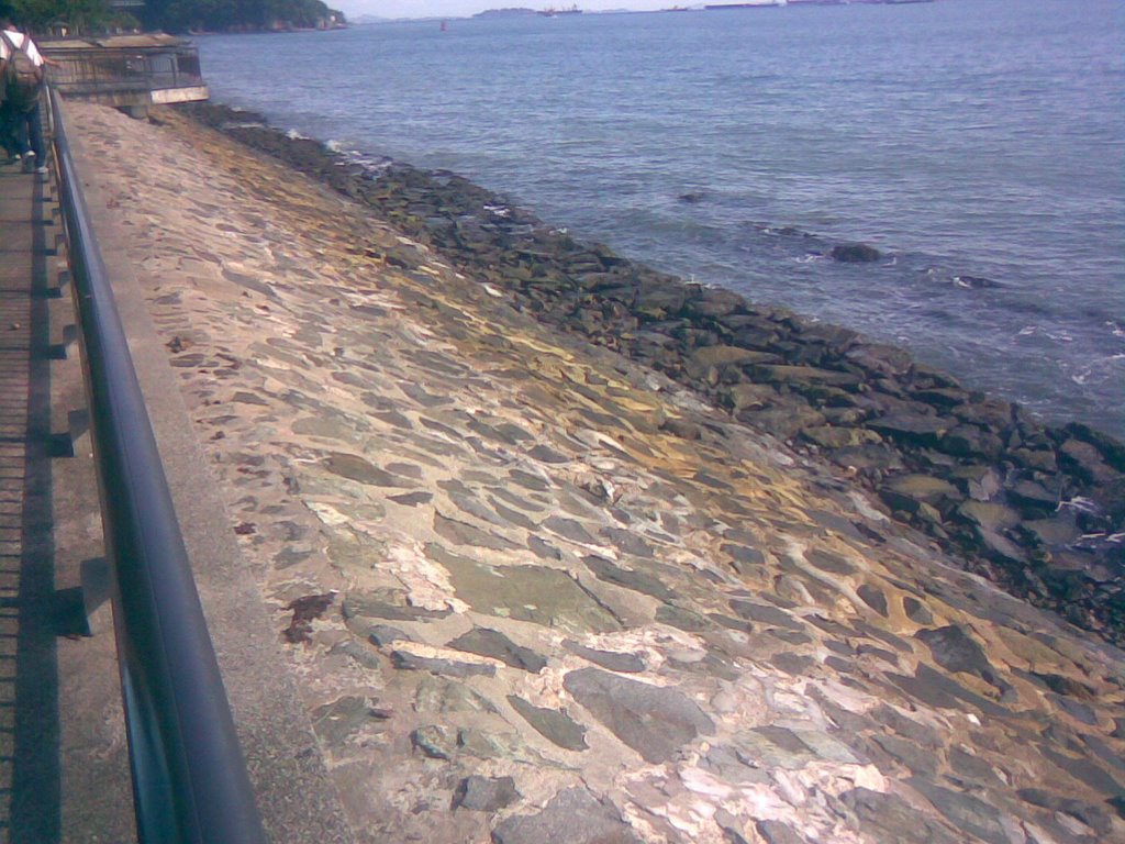
Seawalls are built to reduce the effects of erosion caused by strong waves, by reflecting waves away from the coast.
However, powerful backwash of reflected waves increases the rate of erosion of beach materials, therefore the base of the seawalls are weakened. But in Singapore, the currents of the waves are not as powerful as it is at other parts of the world. For example, Hawaii, Indonesia, Penang, Hong Kong and Japan. In these countries, the fetch is much longer than that of Singapore’s fetch. The reason is because Singapore is surrounded by many other countries. Therefore the wind does not blow over a very large area of water. Hence, the wave power is adversely affected.
However, powerful backwash of reflected waves increases the rate of erosion of beach materials, therefore the base of the seawalls are weakened. But in Singapore, the currents of the waves are not as powerful as it is at other parts of the world. For example, Hawaii, Indonesia, Penang, Hong Kong and Japan. In these countries, the fetch is much longer than that of Singapore’s fetch. The reason is because Singapore is surrounded by many other countries. Therefore the wind does not blow over a very large area of water. Hence, the wave power is adversely affected.
Another factor that influences the wave power is the presence of prevailing winds. In the case of Singapore, our prevailing winds come from the North-east and from the South-west. However, the highlands of other neighbouring countries block most of the winds from reaching Singapore. With less wind power, the wave energy would be lowered.
The Need For Coastal Management
Why?
To slow down/prevent wave erosion
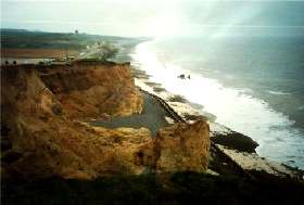 Cliff erosion at Weybourne.
What will happen without coastal management?
-Features disappearing (E.g. beach, coastal dune etc.)
->tourism affected
-Erosion taking place
->Land Retreating
->Flooding
->Unsuitable for settlements (E.g. Beach resort, jetty etc.)
-Port activities affected
->Deep offshore waters -> cannot anchor
->Trade decreases
Examples of Coastal Management
- Seawalls
Purpose?
To reduce the effect of wave erosion
How?
When waves hit the seawalls, the wave energy is concentrated on the seawalls. When waves reach the coast, the waves are weakened, therefore there is lesser energy left to erode the coast.
Disadvantage of building Seawalls
When waves hit the seawalls, the wave erodes the base of seawalls, causing it to weaken and need to be restructured occasionally.
Advantage
Protect the entire coast unlike breakwaters which only protect some part of the coast.
Countries Using Seawalls
- East Coast, Singapore.
- Butterworth, Peninsular Malaysia
- Labrador Park, Singapore
Before:
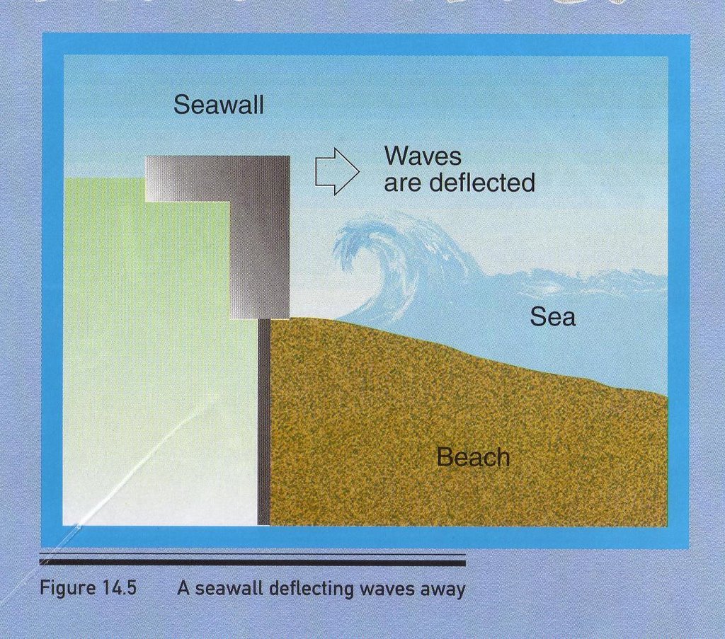
After:
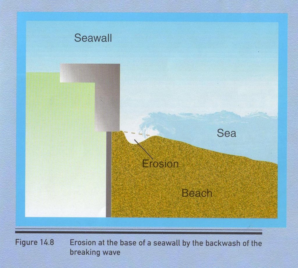
- Groynes
To deal with longshore drift.
How?
When longshore drift hits groynes, this causes deposition on side of groynes facing longshore drift.
Disadvantage of building groynes
Groynes are made up of ugly structure. This affects the beauty of the beach. This indirectly affects tourism. Deposition on one side of groynes causes features unable to form. This indirectly affects tourism.
Advantage of building groynes
Groynes intercept longshore drift, causing loads and sediments to be deposited on side of groynes facing longshore drift.
Countries using Groynes
->Crescent Beach, Canada
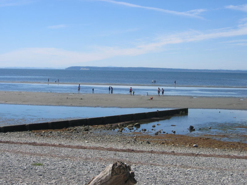 A groyne at Crescent Beach. Surrey, BC, Canada.
- Breakwaters
Purpose
To reduce effect of Wave Erosion
How?
When waves hit the breakwaters, strong erosive power is concentrated on this structure. When waves reach the coast, the erosive power is lesser, therefore wave has lesser energy for erosion, and this slows down the coast erosion.
To reduce effect of Wave Erosion
How?
When waves hit the breakwaters, strong erosive power is concentrated on this structure. When waves reach the coast, the erosive power is lesser, therefore wave has lesser energy for erosion, and this slows down the coast erosion.
Disadvantage of building breakwaters
This structure is built only at some part of the coast. Unprotected parts of coast will be eroded by waves.
Advantage of building breakwaters
This structure causes waves energy to be concentrated on it. When waves reach the coast, it has lesser energy for coastal erosion.
Countries using Breakwaters
->East Coast, Singapore
->Tynemouth, Australia
Before:
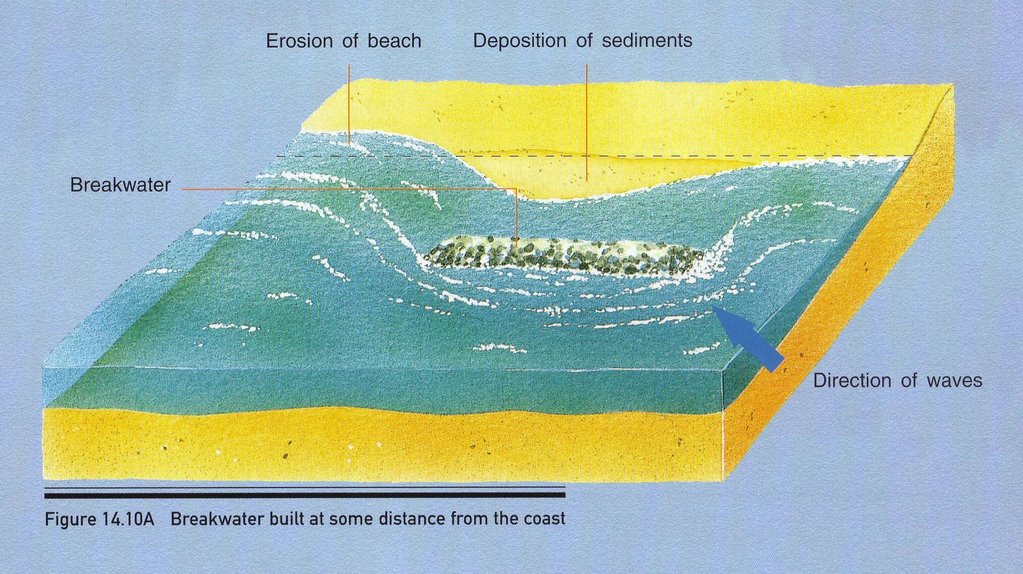
After:
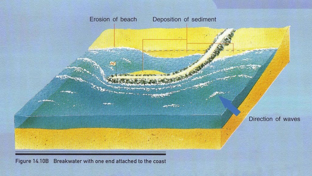
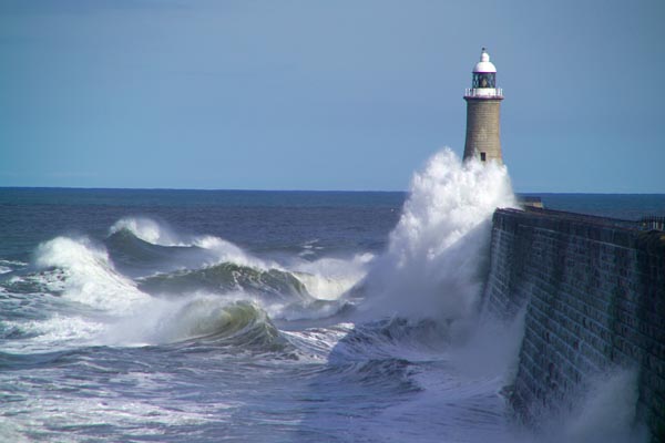 Stormy sea hitting the breakwater at Tynemouth
Sources:
Secondary 3 Geography Textbook
Pictures taken by Group Members at Labrador Park
http://www.freefoto.com/preview.jsp?id=9906-04-17&k=April+2006+BLOG+Images
http://en.wikipedia.org/wiki/Image:Cresbeach-groyne.jpg
http://members.aol.com/wwanglia/gowen4.htm
Subscribe to:
Posts (Atom)