Before the trip to Labrador Park , I thought that it is just like any other parks and there is nothing special about it . However after the trip , my opinion for it has changed . The trip had allowed us to see how does an actual Tropical Rainforest look like . Initially , I was not quite certain if the properties of the Tropical Rainforest that was taught ages ago , apply to any of the Tropical Rainforest . However , now I can assure that it definitely does ! The hot and wet climate enables plant growth throughout the year . Therefore , Labrador Nature Reserve has a rich variety of flora and fauna that will delight nature lovers. During the trip , I had seen several climbing plants , such as lianas . On the dark and damp forest floor , there was much leaf litter . From what I had learnt previously , leaf litter is essential in the Nutrient Cycle , which is a process that allow nutrients to return to the soil . When we were at the foot of the forest , we can clearly see the five distinct layers of the forest . This evidently proved that what we had learnt was absolutely correct !
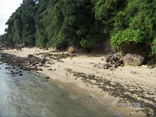
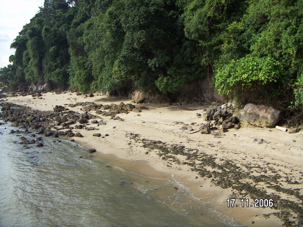
I found out that Labrador Nature Reserve contains the only rocky sea-cliff on the main island of Singapore that is accessible to the public for recreation, education and scientific research ! When I knew that we had to get down to the beach to view the wave-cut platform and calculate the Wave Period , I was reluctant to do so as it was filled with algae and other disgusting substances . However , when I was on the beach itself , I realized that it wasn’t that bad . The only difference between the beach there and the beach in East Coast Park , is that you cannot swim there ! Unless , you intend to drown yourselves . At the wave-cut platform , we saw a notch . We were told that we would not be able to see the notch if it is high tide . Therefore , we are considered fortunate to view the notch . It was totally different experience as the notch that we used to see in textbooks and notes were just pictures . Overtime , due to erosion , the cliff will eventually collapse . It was amazing that the simple waves can cause a huge cliff to collapse . Therefore never underestimate the waves !
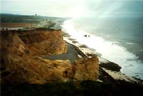
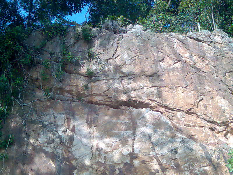
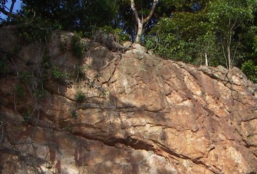
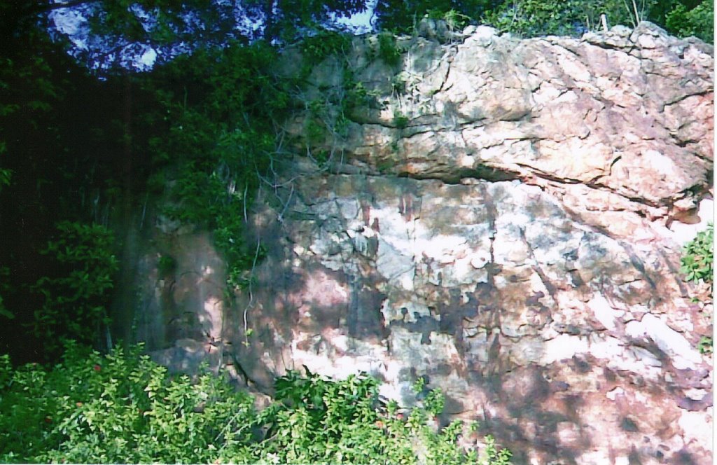
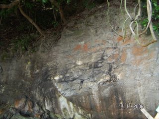
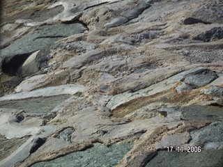
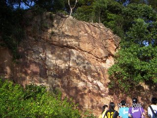
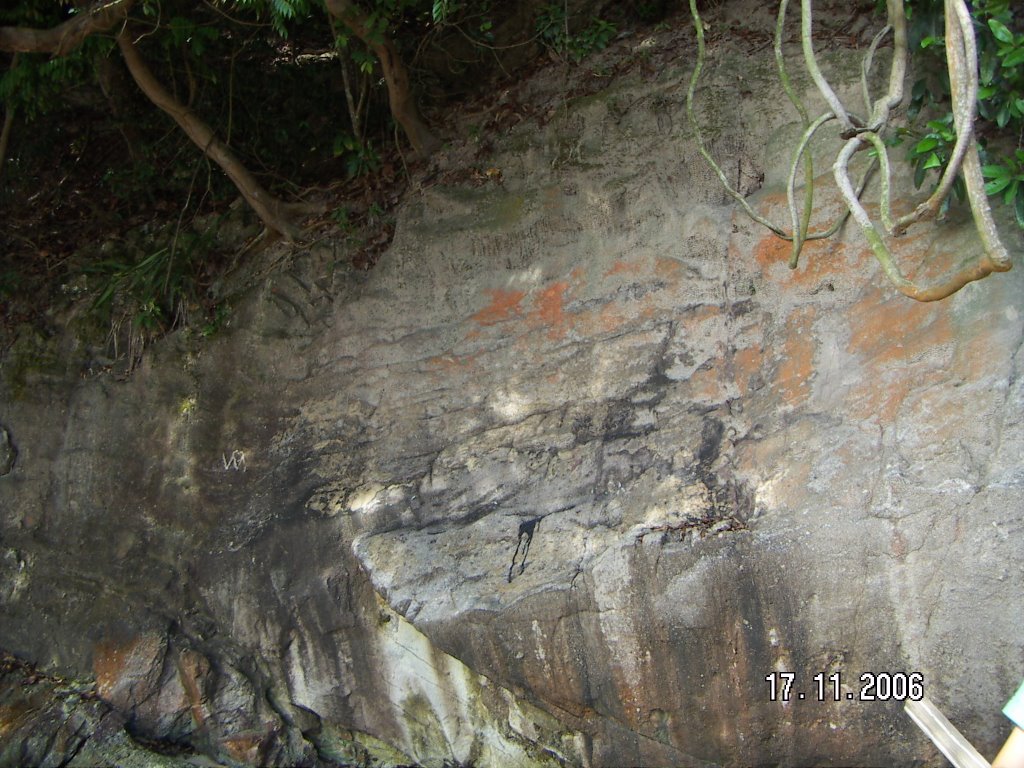
At the Dragon Teeth Gate , the huge cliff was expose to chemical weathering , oxidation , as it was reddish brown .
The lines of weaknesses of the rock and the humid climate increased the rate of weathering . Overtime , the cliff will eventually collapse . Therefore beware when you are walking under it !
During the trip , we saw the efforts of soil conservations and coastal protection . Example like the net , which helps to prevent the soil from eroding . The seawalls , which help to prevent coastal erosion .
In my point of view , I felt that Natural Vegetation is essential to our life . Without it , we will hardly survive as it provide us with endless supply of oxygen and played important role in various aspects . Simple things such as wasting paper , hence , resulting in further deforestation . By cutting down more trees will affect the nutrient cycle , thus , the soil will be infertile and prone to erosion . Due to the development of present world now , the demands of high living standards also increase drastically . Which means that more forest has to be cleared for infrastructure . Factories are also the culprit for deforestation and polluting of water . Land has to be cleared for it and the chemical substances released into the water will harm marine life . Therefore , I strongly believed that it’s everyone duty to conserve the park .
Although we had to walk under the scorching sun , I believed that everyone had benefited greatly . It had help to broaden my knowledge . There are many things that you can at there , such as fishing . If you are fortunate enough the catch is yours . Isn’t it interesting ? However , most importantly it’s FREE ! Been to Labrador park has given me a truly unique experience and I hope that there will be such trips in the future .
Thursday, November 30, 2006
Pei Sze
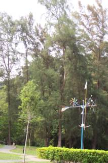
Location1. The Aerial Tower
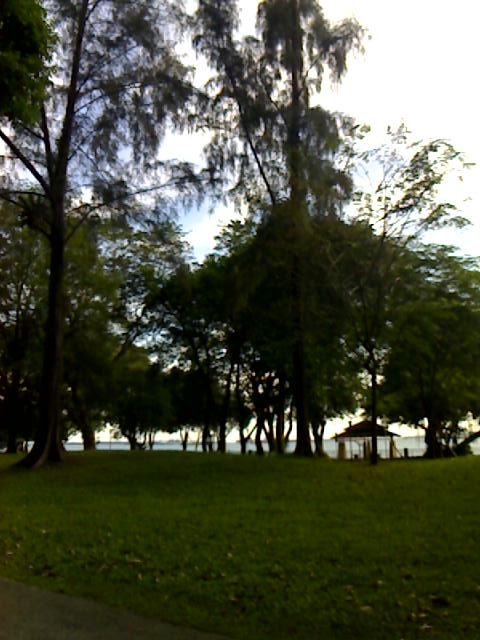
 Able to see the distinct layers of the tropical rainforest.
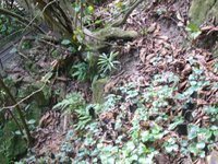
 The dense forest's ground floor. This picture shows how the soil conservation is being carried out.
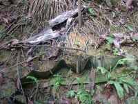
 The dense forest's ground floor. The picture also show that the roots of the tree is shallow and buttress.
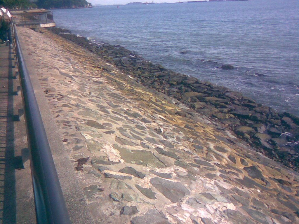
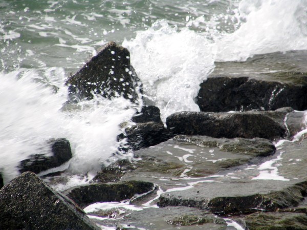
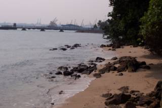
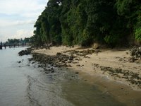 The wave cut plateform that we saw( during low-tide), the shape of the coast.
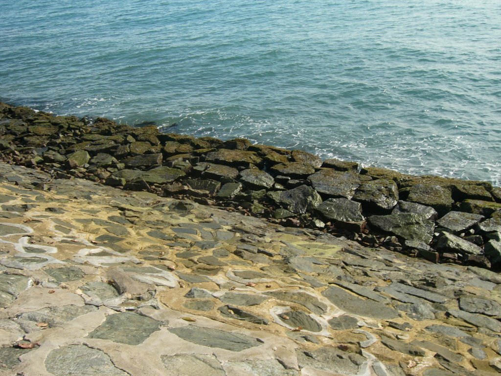
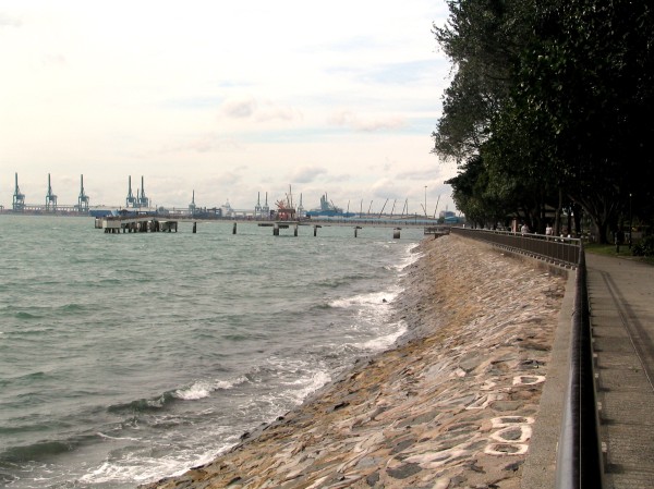
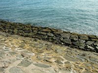 This is the sea-walls that had been built to protect wave erosion.
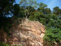 From the colour of the rocks, i could say that both chemical and biological weathering took place. But in this case, chemical weathering was much more dominant than biological weathering. As the reddish-brown iron oxide was shown on the surface of the rock, therefore it shown that oxidation took place.
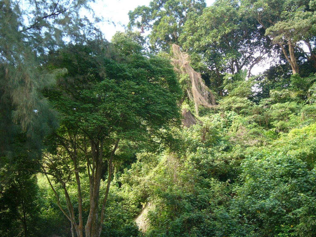 Able to see the distinct layers of the tropical rainforest.
 The dense forest's ground floor. This picture shows how the soil conservation is being carried out.
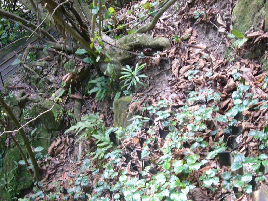 The dense forest's ground floor. The picture also show that the roots of the tree is shallow and buttress.
Location2. Jetty and Rocky Beach
 The wave cut plateform that we saw( during low-tide), the shape of the coast.
Location 3. Promenade
 This is the sea-walls that had been built to protect wave erosion.
Location 4. At the Dragon Teeth Gate
 From the colour of the rocks, i could say that both chemical and biological weathering took place. But in this case, chemical weathering was much more dominant than biological weathering. As the reddish-brown iron oxide was shown on the surface of the rock, therefore it shown that oxidation took place.
Ivy
This fieldtrip to the Labrador Park has been a fruitful experience for me. Unlike usual theory lessons in classroom, this lesson has been an interesting one. This fieldtrip has helped me to link and relate what we have learned in class with our natural environment.
The first location was the Aerial Tower where we saw the natural vegetation. Recalling what I have learnt a few months ago, this staircase walk from the Aerial Tower to the Jetty allowed me to look at the structure of the forest, as well as the characteristics of the leaves. I also saw the different methods of soil conservation.
The second location was the Jetty/ Rocky beach where we learnt about coastal studies. We observed the shape of the coastline and also calculated the wave period. We made our way down and saw the wave-cut platform and the notch. We were told that as waves continue to erode the coast, the cave would eventually collapse.
The third location was the Promenade where we observed coastal management. Seawalls were built to protect the coast. We were also told about the backwash and swash.
The final location was the Dragon Teeth Gate where weathering processes takes place. We were told how the rock would break down eventually by oxidation. This is due to the presence of lines of weaknesses that weaken the rock. We also got to know the historical significance of the Dragon Teeth Gate.
Nowadays, as more and more land is being used for commercial, recreational and industrial uses, it is important that we conserve a nature reserve park like Labrador Park. Everyone has a part to play. If we do not play a part in conserving the Mother Nature, what will happen in 10 years time?
Overall, I have gained much knowledge from this fieldtrip, which enabled me to understand the topics better.
Kiti
 My Reflection
The first location we went to was the Aerial Tower. As we journey down the staircase from the Aerial Tower to the Jetty, I recalled what have been taught in the topic of Natural Vegetation a few months ago. I find it easier to understand what we have learned by looking at the real things rather than just simply reading from the notes or looking at the 2D pictures in it. The leaves in the forest were indeed thick and leathery and smooth and waxy with downward pointing drip tips. Buttress roots were also found. The trees grow very closely to one another, forming a continuous canopy so we were actually sheltered from the sun. The condition inside the forest was hot and humid. The forest floor was dark with lots of leaf litter lying around and little undergrowth was found there. A lot of ants and insects were found in the forest and I saw algae on our way down which I find it surprising. Lianas and a few species of climbing plants were also found in the forest. Methods of soil conservation were also practiced there.
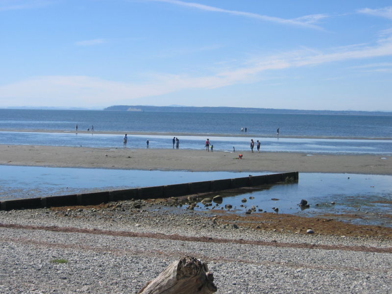
The second location we went to was the Jetty/Rocky Beach. It was lucky for us that we went there during low tide. We saw the wave-cut platform, which is only exposed during the low tide. It was a gently sloping coastal land surface that extends towards the sea from the foot of the cliff. The Rocky Beach was indeed rocky and filled with rocks, with bigger rocks nearer to the foot of the cliff and smaller rocks further away. The beach materials were indeed sorted on the beach. There was a construction of jetty going on. A notch was found at the foot of the cliff. I did not know that it was a notch until Miss Chee pointed it out. Initially I thought that the notch was just an ordinary hole. Further erosion of the notch would make it further enlarged and form a cave. Maybe 50 years later, we would get to see a cave in Labrador Park!
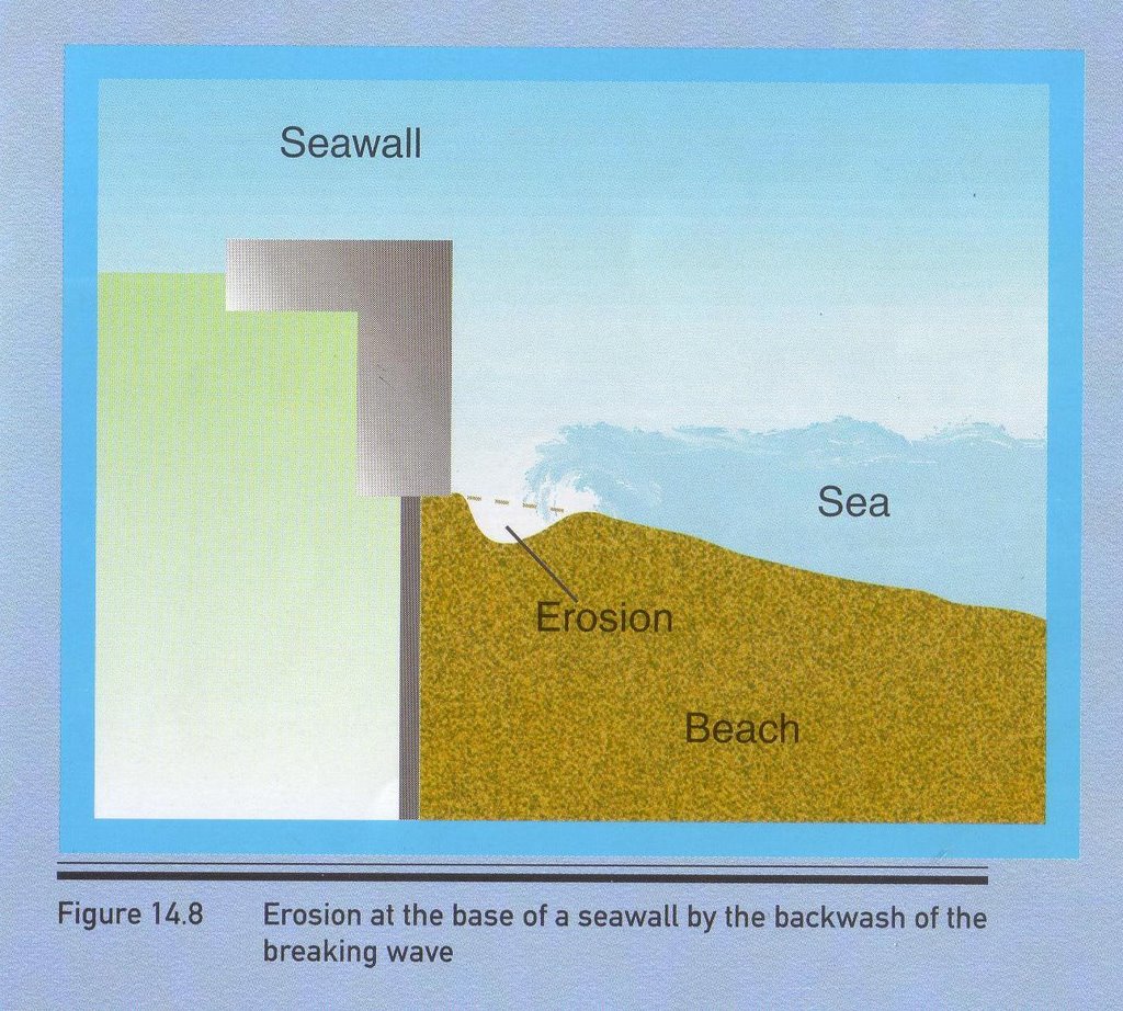
The third location we went to was the Promenade. The coastal protection method used along the Promenade was the building of seawalls. Actually, I have seen seawalls around in Singapore at East Coast and Sentosa in the past few years, but it is just that I did not know how a seawall looks like till this trip to Labrador Park. Building of seawall helps to reduce the effect of the waves and helps to reflect the waves away from the coast. However, building of seawalls have its own disadvantages, powerful backwashes of the reflected waves increase the rate of erosion of the beach materials and also causing the base of the seawalls to weaken resulting in the continuous rebuilding of the seawalls again and again. There are groups of anglers fishing along the Promenade too.
The last location we went to was the Dragon Teeth Gate. The type of rock that is found there is the granite rock. Biological weathering and chemical weathering mainly attacked the type of rock found there. There is evidence of oxidation taking place due the reddish-brown iron oxide that is present on the surface of the rock. The roots of the plants attacked the lines of weaknesses of rocks found there. Remnants of the past like the war relics, tunnels and a fort are also be found there.
Lastly, Labrador Park is one of the few Singapore's nature parks around in Singapore so it is very important to preserve the natural environment in our urban landscape. It is our responsibility to protect and conserve it. Also, Labrador Park is not just a normal park in Singapore. Visitors especially the history and geography students get to observe what they have learned more clearly.
Wednesday, November 29, 2006
Pei Sze

At the Labrador Park, I was being able to have a first hand encounter with the natural vegetation, weathering and the coastal studies, which we had learned them during chapter 5, 9 and 11. The trip had enabled me to know that geography is a subject that can be apply to our surrounding. With this trip I also can experience the things and conceive what we had learned during lesson, from both the notes and textbook.
At the Aerial Tower, where we actually recalled on the tropic on tropical rainforest, which we had studied a few months back. While walking down the steps, we saw a lot different characteristics of the trees, like the leaves, it is smooth and waxy, thick and leathery. The roots are buttress and also shallow that we can actually see the roots sticking out of the ground. Not only just that, when we will walking in the forest, we felt that it was so stuffy. This was because that the forest was so dense that the sun actually cannot enter through the ground floor easily. All this was being learned from the textbook and with this trip we will able to get to encounter the primary experience with just not seeing them in the pictures. Other than that, we also see how the human activities were being applied in order to help to prevent soil erosion from being occurred, other than just planting a lot of plants. Along the way, all of us were like eye-openers, everything to us seems so new and all of us were busy taking down notes and photos. Also reminding each other what to write down and what pictures that we should take.
Due to that we had been there during the time of low tide, all of us were able to see the way cut platform and the whole sharp of the coast. When I saw the notch in the textbook, I thought that it is actually quite small. But the notchthat we had seen there was actually quite big, compare to the notch that I had imagined from the textbook. At the place, we also do a little experiment by calculating the wave length per minute and was ask to draw out the shape of the coastal. Along the way, we saw litters along the coastal, from this I can conclude that human activities can either conserve or destroy the beauty of nature. Along the path of the coastal, we could also see the sea walls and knowing how this man-made structure actually helps to protect the wave erosion through the textbook. I also experience the sea breeze and forgetting the backwash and swash too.
Weathering of the rocks were also been seen when we process to the next location, the cliff that we seen was reddish brown in colour. From that I had applied to what I had learned during lesson that the chemical weathering actually took place, oxidation. Lines of weakness were also been shown and other than chemical weathering took place, biological weathering also took place.
Nowadays due to the development of Singapore, many of the lands had been actually used to build houses and factories, with this, it becomes very important to preserve a original green landscape which Singapore have, instead of being turn into a concrete city. Therefore, it’s our job to preserve what we have now.
All this information that we had learned during lesson actually apply fully to this trip, therefore I could say that this trip was a beneficial one for me.
Howe Yong
Hi. I feel that the trip to Labrador park was a rather meaningful one compared to the last time we were there. As it is a nature reserve, so there will naturally be a lot of conservation going on. However, by conserving Labrador park, we not only conserve our natural vegetation there, we preserve our coastal features there as well and learn the ways in which to protect it. All of this made me realise how fragile nature actually was, and it was of importance to start conserving it. However, we cannot leave such works only to the conservationist out there in the field. We ourselves must also play a part in conserving our natural elements. Ok, now on to the things that we saw during this field trip. Firstly, when we came down from the bus, i saw the floor. Ok, that was crap. Our first destination was in fact, the aerial tower, which gave us a spectacular view of the sea and the natural vegetation, such as the structure of the forest. After that, we made our way down where we came across some methods of soil conservation. After that, we went to the beach where we calculated wave period and we learned about the wave-cut platform and how it was formed. After that we headed along the pathway and along the way, we learned about seawalls and how it prevents the shore from being eroded. Following that, we came across a gigantic cliff that has been battered by the various weathering processes. However, we found out that the main weathering process happening there was in fact oxidation, as the rock was reddish-brown in colour, thus indicating the presence of iron in the rock. Also, there was a gun station just beside the cliff and that was where i met Johnny. Our final destination was at a piece of rock called(direct translation from Chinese)dragon teeth gate. This rock had also been weathered by oxidation as well as the roots of plants. I felt that i learned many things from this trip and i would gladly go back there again. Also, I learned something about my friend too. For example, wang zhi gets nose his bleeding very easily. Thats about all. Thank you.
Some Things to Think About
Dear Geographers,
You may want to address some of the following questions/ issues in your individual reflections:
1) What is the value of conserving Labrador Park as a Nature Reserve?
2) Whose job is it to conserve the environment?
3) Assess/ evaluate the type of conservation work that has taken place at Labrador Nature Reserve.
4) Have you learned anything new about your friends/ classmates on this trip?
Deadline for individual and group assignments remains as stated: 4 Dec 2006, 2359hrs. Kindly remind your friends to pen their thoughts if they have not yet done so. To those who have already submitted a post, your efforts are appreciated and do feel free to post more.
That's all for now...
Siang Yee
After going to Labrador Nature Reserve, I have learnt more about Natural Vegetation, Coastal Studies and Weathering which I learnt in classroom. At the Aerial Tower, I have seen the method of soil conservation and the features of the tropical rainforest.
At the Rocky Beach, I have seen how notch and wave-cut platform look like in the real life. At the Promenade, I learnt that seawalls and rocks protect coast from wave erosion. At the Dragon Teeth Gate, I have seen the effects of oxidation on rocks containing iron minerals. From the fieldtrip, I learnt more about Geography through experiential learning.
At the Rocky Beach, I have seen how notch and wave-cut platform look like in the real life. At the Promenade, I learnt that seawalls and rocks protect coast from wave erosion. At the Dragon Teeth Gate, I have seen the effects of oxidation on rocks containing iron minerals. From the fieldtrip, I learnt more about Geography through experiential learning.
Pan Hui
Going to Labrador Park benefits me a lot. I never knew how these notches, caves, wave-cut platforms and seawalls really look before going on this trip. I always saw those rocky structures and wondered what that was, now i know that they were called seawalls. Throughout the whole journey, i saw many things that we learnt in the textbooks. Examples were coastal features, leaf litter, protections of beach and soil. Now it will be much easier to understand the many different features in the notes. By remembering the looks of the features, it will be easier to link the various facts together rather then just memorising it. I think that every activity are beneficial as all help to reinforce the facts that we might have forgotten months ago. I hope that we can go on more of this kind fieldtrips next year.
Group 3 - Location 3: Coastal Management
Geography
Labrador Park Fieldtrip
Our second fieldtrip of the year, Labrador Park. The objective of this fieldtrip was to observe the various man-made and also natural coastal features. What my group and I were focusing on, was coastal protection features.
The main feature to look out for at Labrador Park were seawalls.
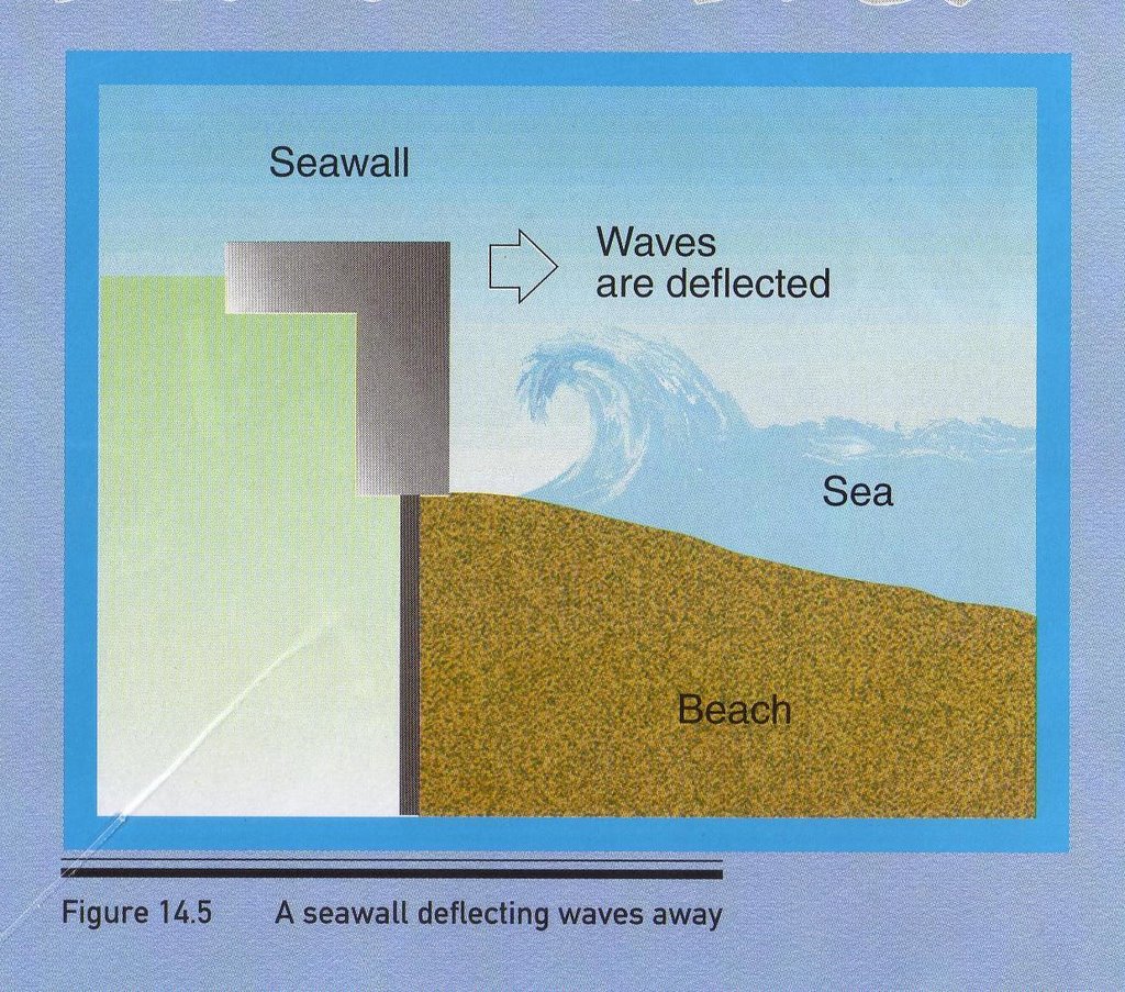
Seawalls
Seawalls are built to reduce the effects of erosion caused by strong waves, by reflecting waves away from the coast.
However, powerful backwash of reflected waves increases the rate of erosion of beach materials, therefore the base of the seawalls are weakened. But in Singapore, the currents of the waves are not as powerful as it is at other parts of the world. For example, Hawaii, Indonesia, Penang, Hong Kong and Japan. In these countries, the fetch is much longer than that of Singapore’s fetch. The reason is because Singapore is surrounded by many other countries. Therefore the wind does not blow over a very large area of water. Hence, the wave power is adversely affected.
However, powerful backwash of reflected waves increases the rate of erosion of beach materials, therefore the base of the seawalls are weakened. But in Singapore, the currents of the waves are not as powerful as it is at other parts of the world. For example, Hawaii, Indonesia, Penang, Hong Kong and Japan. In these countries, the fetch is much longer than that of Singapore’s fetch. The reason is because Singapore is surrounded by many other countries. Therefore the wind does not blow over a very large area of water. Hence, the wave power is adversely affected.
Another factor that influences the wave power is the presence of prevailing winds. In the case of Singapore, our prevailing winds come from the North-east and from the South-west. However, the highlands of other neighbouring countries block most of the winds from reaching Singapore. With less wind power, the wave energy would be lowered.
The Need For Coastal Management
Why?
To slow down/prevent wave erosion
 Cliff erosion at Weybourne.
What will happen without coastal management?
-Features disappearing (E.g. beach, coastal dune etc.)
->tourism affected
-Erosion taking place
->Land Retreating
->Flooding
->Unsuitable for settlements (E.g. Beach resort, jetty etc.)
-Port activities affected
->Deep offshore waters -> cannot anchor
->Trade decreases
Examples of Coastal Management
- Seawalls
Purpose?
To reduce the effect of wave erosion
How?
When waves hit the seawalls, the wave energy is concentrated on the seawalls. When waves reach the coast, the waves are weakened, therefore there is lesser energy left to erode the coast.
Disadvantage of building Seawalls
When waves hit the seawalls, the wave erodes the base of seawalls, causing it to weaken and need to be restructured occasionally.
Advantage
Protect the entire coast unlike breakwaters which only protect some part of the coast.
Countries Using Seawalls
- East Coast, Singapore.
- Butterworth, Peninsular Malaysia
- Labrador Park, Singapore
Before:
After:
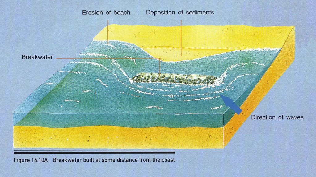
- Groynes
To deal with longshore drift.
How?
When longshore drift hits groynes, this causes deposition on side of groynes facing longshore drift.
Disadvantage of building groynes
Groynes are made up of ugly structure. This affects the beauty of the beach. This indirectly affects tourism. Deposition on one side of groynes causes features unable to form. This indirectly affects tourism.
Advantage of building groynes
Groynes intercept longshore drift, causing loads and sediments to be deposited on side of groynes facing longshore drift.
Countries using Groynes
->Crescent Beach, Canada
 A groyne at Crescent Beach. Surrey, BC, Canada.
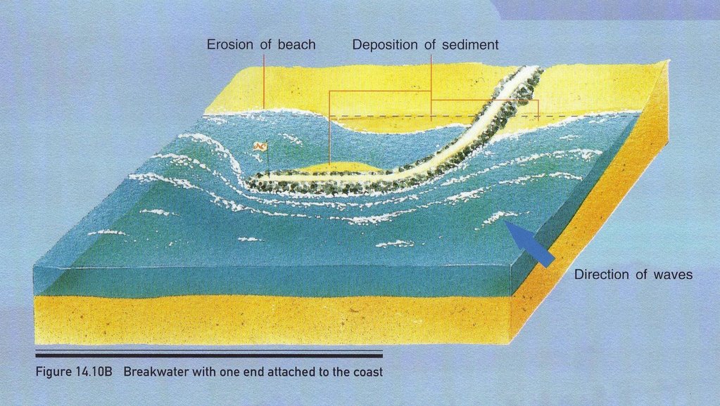
- Breakwaters
Purpose
To reduce effect of Wave Erosion
How?
When waves hit the breakwaters, strong erosive power is concentrated on this structure. When waves reach the coast, the erosive power is lesser, therefore wave has lesser energy for erosion, and this slows down the coast erosion.
To reduce effect of Wave Erosion
How?
When waves hit the breakwaters, strong erosive power is concentrated on this structure. When waves reach the coast, the erosive power is lesser, therefore wave has lesser energy for erosion, and this slows down the coast erosion.
Disadvantage of building breakwaters
This structure is built only at some part of the coast. Unprotected parts of coast will be eroded by waves.
Advantage of building breakwaters
This structure causes waves energy to be concentrated on it. When waves reach the coast, it has lesser energy for coastal erosion.
Countries using Breakwaters
->East Coast, Singapore
->Tynemouth, Australia
Before:
After:
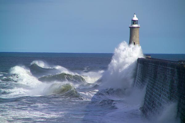 Stormy sea hitting the breakwater at Tynemouth
Sources:
Secondary 3 Geography Textbook
Pictures taken by Group Members at Labrador Park
http://www.freefoto.com/preview.jsp?id=9906-04-17&k=April+2006+BLOG+Images
http://en.wikipedia.org/wiki/Image:Cresbeach-groyne.jpg
http://members.aol.com/wwanglia/gowen4.htm
Tuesday, November 28, 2006
Yan Ling

 The fieldtrip to Labrador park allows me to have a better and clearer understanding on the topics I had learnt during lesson.This fieldtrip made me realise that geographer not only need to learn from the textbook but also have hands-on experience like observing the nature, which will allows us to learn things that are not found in textbook like how soil conservation is done.
Through the fieldtrip, I am able to link to what I observed in the fieldtrip with what I had learnt in class. I hope that there will be more fieldtrip in future so as to help us in understanding geography and its features better.
Yie Yng
Going to Labrador Park for the fieldtrip is a good experience for me. I get to see weathering, coastal protection and the natural vegetation in person. Through this fieldtrip, I get to learn better. I get to link what is observed in the fieldtrip to what was learnt in the classroom. We also get to see and get close to nature instead of just looking at the pictures in our textbook. This helps us to understand better. I also hope that we can have more of such fieldtrips in the future.
Sunday, November 26, 2006
Jun Hao
The Labrador Nature Reserve allows us to see many different things we learn in class.
Firstly, we visited the Aerial Tower. This location allows us to see the features and structure of a forest in reality and not just pictures or diagrams. It was interesting looking at climbing plants and the dense, dark and damp forest floor. Methods of soil conservation were also seen, allowing us to learn something new from this fieldtrip and not just see what we have learned in class.
Next, we visited the Jetty and Rocky Beach. This allows us to see how the waves travel as they move towards the coast. I saw the white foam that is formed when the crests move forward and trap air when it collapses and break. I also saw the backwash carrying materials back into the sea. The wave period was also measured.
The third location we visited was The Promenade. Over here, we saw seawalls, a method of protecting the coast against coastal erosion. By looking at the seawalls in reality, it is easier to visualise them and so, making it easier to know where and how it is built, such as building it parallel to the coast.
The final location we visited was the Dragon Teeth Gate. Here we saw weathering processes taking place such as Oxidation. This enabled me to see what oxidation looks like as I could not visualise it.
This Geography Fieldtrip to Labrador Nature Reserve assisted me in my understanding of some topics in Geography. By looking at the real thing, such as swash, the different layers of the forest, coastal management(seawalls), it allows me to visualise them easily, making it easier for me to know their properties and how they are formed.
Saturday, November 25, 2006
Kian Kiat
This fieldtrip allowed me to see things of what we have learnt.(Example Swash And Backwash,Weathering of Dragon Teeth Gate)This fieldtrip exposed us to 3D pictures instead of always looking at 2D pictures.Miss Chee said that "o" Level examiner are trying to come out with more pictures rather than 2D image( like our notes ) ,therefore this fieldtrip allow us to look at more of 3D pictures.For weathering,i thought that there could only be one process taking place at a time,but this fieldtrip tells me that in real fact,there is different type of weathering taking place.(Example Dragon Teeth Gate,Eroded by Oxidation and biological weathering.)Also,this fieldtrip allows us to study the geography notes easier.For example,the weathering process that was taking place on the dragon teeth gate,we can directly explain how this happen instead of keep memorising the words.If wasn't for the fieldtrip,i would have mistaken the seawalls as the breakwater because in notes,we couldn't really get to see how a seawalls or breakwater looks like.I also notice that Singapore has different type of coastal management.Examples are seawalls,breakwater and placing boulders.In Labrador Park,we can only find boulders and seawalls.This trip also allow us to recall what we have learnt earlier on.Examples are forest structure(Why is the forest structure dark?Answer:due to continuous canopy block sunlight from passing through the forest ground.)and weathering of dragon teeth gate(what is the process that break down the dragon teeth gate?Answer:plants grow into rock's line of weaknesses and oxidation.)
This trip was a useful one as it could help us recall what we have learnt.
This trip was a useful one as it could help us recall what we have learnt.
Friday, November 24, 2006
Yennting
 Been there at Labrador Nature Reserve makes me realized that geography are everywhere around us. It allows us to understand more than what we had learnt from the textbooks.
The first location that we went was the Aerial Tower. This is where we remember what we had learnt months ago about the natural vegetation, particularly the tropical rainforest. As we journeyed down the staircase from the Aerial Tower to the Jetty, we saw the five distinct layers of the rainforest, and of course, not forgetting about the leathery drip-tip leaves (as what we had learnt from). Not only that, we saw how soil conservation was done to prevent soil erosion. I was really amazed by how the soil conversation is done as I used to think that preventing soil erosion is just to plant more trees to hold on to the soil.
The second location was the jetty and the rocky beach where we do our coastal studies. The first sight of the rocky beach makes me feel rather disgusted. "It was so dirty and unhygienic. Why do we have to go down there?" However, after seeing all the coastal features down there, my views for the beach changed. It was pretty useful after all. It showed us what a wave-cut platform really looks like, how a notch really looks like. We were told there that the cliff will  collapse overtime as the waves continue to erode it. However, the cliff is not only being eroded by the waves. It was being weathered biologically by the plants that grew on the top of it too. So, we know that geography links everything together.
 collapse overtime as the waves continue to erode it. However, the cliff is not only being eroded by the waves. It was being weathered biologically by the plants that grew on the top of it too. So, we know that geography links everything together.
 The third location we went was the Promenade. We could see the actual seawalls as well as the backwash and swash. Feeling the sea breeze blowing on you on such a hot and humid day was really relaxing.
Lastly at the Dragon Teeth Gate, we saw a cliff reddish-brown in color, obviously experiencing oxidation. Although it was already experiencing chemical weathering, biological weathering by the roots of the plants on top of the cliff is growing into the lines of weakness present as well.
I believe that more of these fieldtrips will benefit us even more in learning the chapters, or even recalling the features during tests and examinations.
Jing Yi
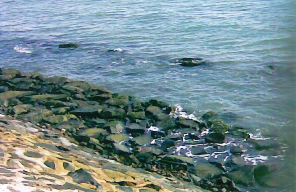

 The fieldtrip at Labrador Park allows me to experience things that were not found in the textbook like how soil conservation is done, how a wave-cut platform, notch and the seawalls look like.A wave-cut platform can be like the normal beaches we found by the sea.
While walking down the aerial tower, we're able to see the different types of vegetation growing in it which we might not be able to see at other places. As we went during the low-tide periods, we're able to see the wave-cut platform which would be covered up during high-tide. As we walk toward the Dragon Teeth Gate, we could see that seawalls were built along the coastto how reduce the erosion cause by the waves. Lastly at Dragon Teeth Gate,we saw a rock that experiences both the chemical and biological weathering. We knew it as the colour if the rock is reddish-brown and had some plants growing on it.
Out of all the locations that we went, I think that I benefit the most at the Dragon Teeth Gate. As I learn how to determine the types of weathering acting on the rocks and by looking at the colour of the rock, I'm able to know if it contains iron in it or other type of minerals.
Xiu Hui
After going on the geography fieldtrip to Labrador Park, I saw what I had learnt in the textbook. I saw how a notch really looked like, what a wave-cut platform is, how a seawall look like etc.
I have always thought that a notch is just a small hole at the base of a cliff but during the trip, I found out that a notch is not just a small hole. In fact, it is quite large. I also saw the seawall at Labrador Park and I realized that I have actually seen it before in other parts of Singapore – only that I did not know it was called a seawall. I saw how soil conservation was done in the rainforest at the park, something I have not seen before.
I have always thought that a notch is just a small hole at the base of a cliff but during the trip, I found out that a notch is not just a small hole. In fact, it is quite large. I also saw the seawall at Labrador Park and I realized that I have actually seen it before in other parts of Singapore – only that I did not know it was called a seawall. I saw how soil conservation was done in the rainforest at the park, something I have not seen before.
Besides seeing what I have learnt in my textbook, I have also seen and learnt many things which are not in our context. I feel that this trip to Labrador had been a fruitful trip.


Wednesday, November 22, 2006
Bao Ting
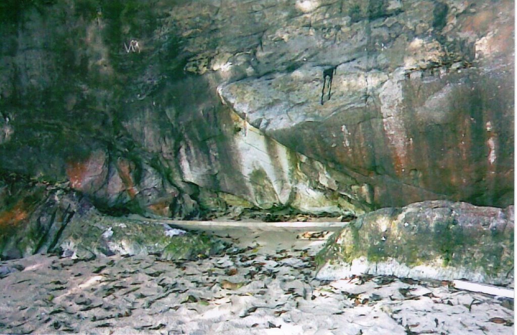
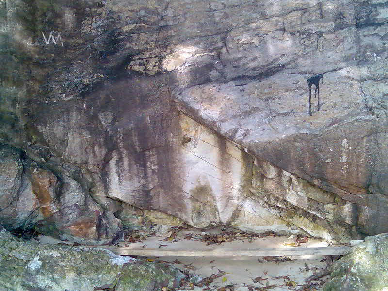
Rocky Beach
.jpg)
.jpg)
.jpg)
.jpg)
.jpg)
.jpg)
Seawalls
.jpg)
Soil Conservation Method
.jpg)
Evidence of Leaf Litter
.jpg)
Cliff with the bottom being eroded
.jpg)
Going to Labrador Nature Reserve for the geography fieldtrip, I think it is rather beneficial. I get to see what I learn from the textbook and understand that geography applies to the present life. Throughout the fieldtrip, I am also constantly recapped of the topics I have previously studied. They are Natural Vegetation, Weathering and Coastal Studies.
Walking down the staircase on the edge of the secondary forest, where the fieldtrip started, I get to see the in-depth of the forest. The five different layers of the tropical rainforest can be observed. However, not all layers are that distinct though. The leaves are indeed evergreen, thick and also smooth and waxy. The ground layer left me with the greatest impression; it is dark and moist, covered with much leaf litter. There is also evidence of climbing plants like Lianas. Alongside the staircase, I also see the practice of soil conservation. Anyway, it is really irritating with mosquitoes buzzing around everywhere.
Reaching the bottom of the staircase, I begin to see the coastal related features. We proceeded to the jetty first then down to the beach. From the jetty, erosional features like the cliff and the wave-cut platform can be clearly seen. Part of the cliff has been eroded by the waves. People are also fishing there as well as along the promenade other than strolling and jogging. Down at the small stretch of Rocky Beach full of big rocks and boulders, I experience the low tide. During the fieldtrip, we also had to learn and to calculate wave periods. Looking at the waves, I am reminded of the swash and backwash. Swash really bring along white foams! Along the promenade, I manage to see how a seawall looks like. It is actually a part of coastal management which reduces the effect of the strong waves that helps to prevent further erosion.
Finally, to the Dragon Teeth Gate, I see the evidence of weathering taking place. They are biological weathering as well as oxidation. I know the rock there is actually undergoing oxidation when I the see the reddish-brown colour which proves the prescence of iron oxide. For biological weathering, the reason why it is proven to be undergone by the rock is because of the plants that are growing on the top of it. I feel that learning outside the classroom is relevant after having personally seen the things and features we learnt before.
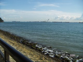
To summarize, even though everyone had to walk and learn under the hot sun, it is worthwhile. Labrador Nature Reserve is also a place with perfect scenery. It offers a panoramic view of the sea and the Western end of Sentosa Island can be viewed too. Besides just learning, everyone joked along the way and took pictures. I hope there will be more fieldtrips in future.
Walking down the staircase on the edge of the secondary forest, where the fieldtrip started, I get to see the in-depth of the forest. The five different layers of the tropical rainforest can be observed. However, not all layers are that distinct though. The leaves are indeed evergreen, thick and also smooth and waxy. The ground layer left me with the greatest impression; it is dark and moist, covered with much leaf litter. There is also evidence of climbing plants like Lianas. Alongside the staircase, I also see the practice of soil conservation. Anyway, it is really irritating with mosquitoes buzzing around everywhere.
Reaching the bottom of the staircase, I begin to see the coastal related features. We proceeded to the jetty first then down to the beach. From the jetty, erosional features like the cliff and the wave-cut platform can be clearly seen. Part of the cliff has been eroded by the waves. People are also fishing there as well as along the promenade other than strolling and jogging. Down at the small stretch of Rocky Beach full of big rocks and boulders, I experience the low tide. During the fieldtrip, we also had to learn and to calculate wave periods. Looking at the waves, I am reminded of the swash and backwash. Swash really bring along white foams! Along the promenade, I manage to see how a seawall looks like. It is actually a part of coastal management which reduces the effect of the strong waves that helps to prevent further erosion.
Finally, to the Dragon Teeth Gate, I see the evidence of weathering taking place. They are biological weathering as well as oxidation. I know the rock there is actually undergoing oxidation when I the see the reddish-brown colour which proves the prescence of iron oxide. For biological weathering, the reason why it is proven to be undergone by the rock is because of the plants that are growing on the top of it. I feel that learning outside the classroom is relevant after having personally seen the things and features we learnt before.
To summarize, even though everyone had to walk and learn under the hot sun, it is worthwhile. Labrador Nature Reserve is also a place with perfect scenery. It offers a panoramic view of the sea and the Western end of Sentosa Island can be viewed too. Besides just learning, everyone joked along the way and took pictures. I hope there will be more fieldtrips in future.
Tuesday, November 21, 2006
Loh Yi Rong
The visit helped us to be able to visualise what we learned in class like the receding cliffside and the effects of erosion.This would help us because in tests and exams it would be easier to recall pictures than words.We also learned about other topics like weathering and rainforest structure.I guess this would help because we actually see what the result of oxidation,for example,is rather than just memorising it,I never actually thought of rusting taking place that way.We also got to see how the cliff was slowly backing away from the ocean,so it was interesting to note that(on one hand) the rocks at its base might be some of its more resistant constituent elements.On the other hand,they might have been some washed up by the waves,I never knew they could be that strong so it was interesting to learn that.We also learnt how to tell the difference between high tide and low tide levels,something we didn't learn in class.
Sunday, November 19, 2006
Post-Fieldtrip Activities - Assessment
Hello Geographers! I hope you've enjoyed the fieldtrip to Labrador Nature Reserve on Friday 17 November 2006 and have learned something from the experience.
As with all fieldtrips, meaningful learning takes place when you are able to make connections between what has been taught in the classroom and what is observed in the field.
The following 2 assignments constitute part of your CA for Term 1 2007.
1. Group Activity: Our Learning Journey (20 marks)
Each assigned group will take charge of providing information (content) for each of the following sections/ labels:
(a) Location 1: Natural Vegetation
(b) Location 2: Coastal Studies
(c) Location 3: Coastal Protection
(d) Location 4: Weathering & History
Each section will be assessed based on the following criteria:
(a) Clear understanding of concepts
(b) Ability to link what is observed in the field to what is learned in the classroom
(c) Detailed (meaningful) explanation of activities carried out
(d) Useful pictures/ photographs
(e) Ability to introduce concepts/ examples outside of the textbook/ syllabus relevant to the topic/ section
Please note that the groups have been allocated randomly. I expect you will be able to work with any of your classmates by focussing on the task at hand rather than on any differences which you may have. Please refer to the 1st post for each section/ label for a list of the members responsible for providing the information.
Please find some time to discuss how you wish to present the information so that it is organised and easy to understand. Each group is made up of 9 members so the leaders (names in bold) must be able to delegate the tasks well and ensure ideas are well-communicated to ALL group members. You may use the fieldtrip worksheets as a guide for your posts and provide an account of the type of activities carried out at that location. At the same time, I would expect more details to be included and links to the topic to be made. The name(s) of the author(s) should be indicated as the title for each post.
2. Individual Activity: My Reflections (20 marks)
Please refer to the section/ label 'My Reflections' for more details on this.
Things to Note:
1) Any updates by me will appear under ‘Teacher’.
2) Please remember to categorise your post under the label ‘My Reflections’ for individual reflections and any of the 4 sections assigned to your group for the group assignment:
(a) Location 1: Natural Vegetation
(b) Location 2: Coastal Studies
(c) Location 3: Coastal Protection
(d) Location 4: Weathering History
3) For both the group and individual activity, please also include your name(s) as the title for each post for assessment purposes.
4) This blog belongs to the Pure Geography Class of 2006-2007 of QTSS. Access to the blog has been given to its members with confidence. Please respect every member's right to post and do not give access to others without permission.
General Information
To create a post, please refer to the following information:
Website: https://beta.blogger.com/start
Blog Username: Refer to worksheet
Password: Refer to worksheet
To read posts, please refer to the following:
Blog Address: http://qtss-geography.blogspot.com/
Period of assessment: 20 November 2006 to 4 December 2006
Instructions
Individual Activity: My Reflections (20 marks)
Each pupil is required to post his/ her reflections in the section/ label ‘My Reflections’. There is no limit to the number of reflections you can post. The following are some guiding questions for you to reflect on, including the criteria for assessment. Depending on the content of your reflections, I will post some new questions for discussion during this two-week period for you to reflect on.
Guiding Questions:
(a) Describe your experience on this fieldtrip.
(b) What are your learning points? (i.e. content knowledge and other areas)
(c) Did what you observed on the fieldtrip help to make what you have learned in the classroom more relevant/ interesting?
(d) Highlight one activity that you found most beneficial and explain why it was so.
Criteria for Assessment:
(a) Clarity of description/ reflection
(b) Organisation of thoughts
(c) Depth of discussion
(d) Relevance
Remember to include your name in the title of every post!
Saturday, November 18, 2006
Group Members
Group 4 - Location 4: Weathering & History of Labrador Park
Group Members:
1) Wang Zhi (Leader)
2) Johans Wong
3) Woo Jun Hao
4) Yee Kun Xiu
5) Kevin Yeo
6) Anastasia Lau
7) Bethany Freeman
8) Woo Siew Wei
9) Loh Yi Chin
Group Members:
1) Wang Zhi (Leader)
2) Johans Wong
3) Woo Jun Hao
4) Yee Kun Xiu
5) Kevin Yeo
6) Anastasia Lau
7) Bethany Freeman
8) Woo Siew Wei
9) Loh Yi Chin
Friday, November 17, 2006
Group Members
Group 3 - Location 3: Coastal Management
Group Members:
1) Kiti Tan (Leader)
2) Toh Yie Yng
3) Wang Yan Ling
4) Yeo Jing Yi
5) Chang Ruey Jing
6) Ong Chuan Hao
7) Sim Siang Yee
8) Tan Howe Yong
9) Tan Kian Kiat
Group Members:
1) Kiti Tan (Leader)
2) Toh Yie Yng
3) Wang Yan Ling
4) Yeo Jing Yi
5) Chang Ruey Jing
6) Ong Chuan Hao
7) Sim Siang Yee
8) Tan Howe Yong
9) Tan Kian Kiat
Group Members
Group 2 - Location 2: Coastal Studies
Group Members:
1) Loo Bao Ting (Leader)
2) Ivy Lu
3) Mildred Ang
4) Janet Ng
5) Ong Xiu Hui
6) Jackie Lee
7) Rico Lo
8) Loh Yi Rong
9) Nicholas Yee
Group Members:
1) Loo Bao Ting (Leader)
2) Ivy Lu
3) Mildred Ang
4) Janet Ng
5) Ong Xiu Hui
6) Jackie Lee
7) Rico Lo
8) Loh Yi Rong
9) Nicholas Yee
Group Members
Group 1 - Location 1: Natural Vegetation
Group Members:
1) Chng Pei Sze (Leader)
2) Chua Mei Qi
3) Goh Pan Hui
4) Ho Yenn Ting
5) Ann Lee
6) Chan Li Zhong
7) Chia Kuan Koon
8) Eddie Koh
9) Eric Ng
Group Members:
1) Chng Pei Sze (Leader)
2) Chua Mei Qi
3) Goh Pan Hui
4) Ho Yenn Ting
5) Ann Lee
6) Chan Li Zhong
7) Chia Kuan Koon
8) Eddie Koh
9) Eric Ng
Subscribe to:
Posts (Atom)